The Great Himalayan Expedition on Motorbikes


Thread Starter #16
Joined
Apr 24, 2012
Messages
1,384
Likes
807
Location
Kerala
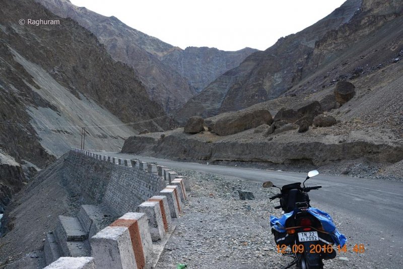
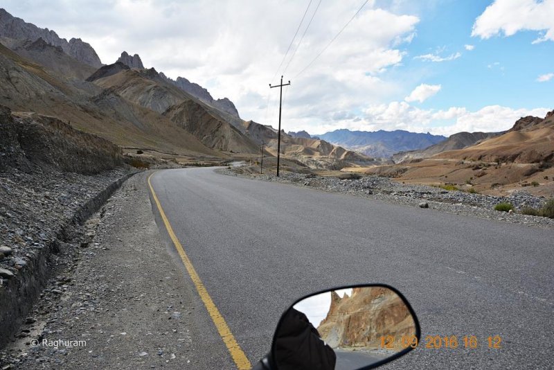
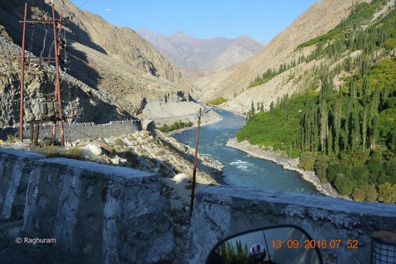
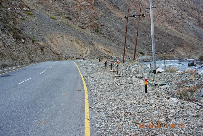
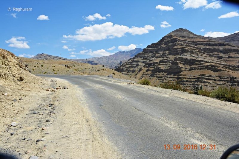
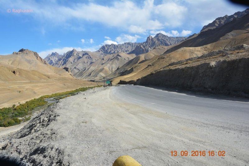
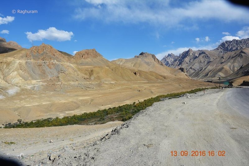
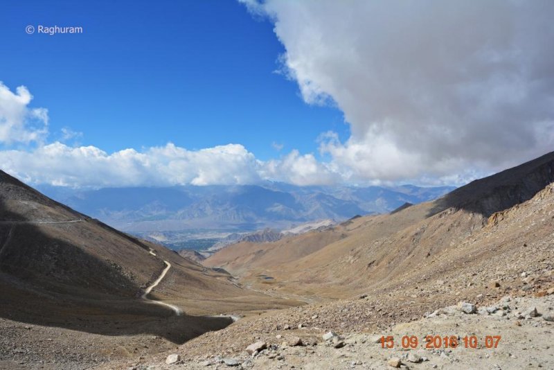
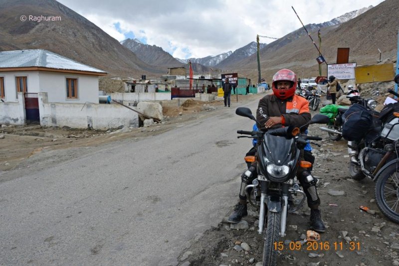
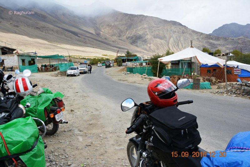
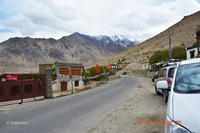
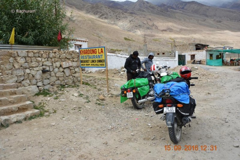
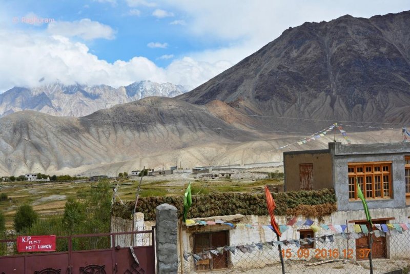
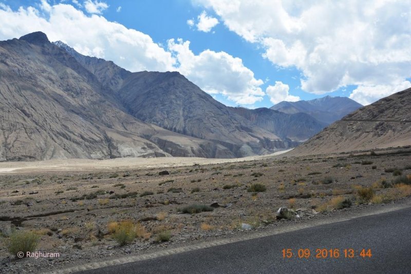
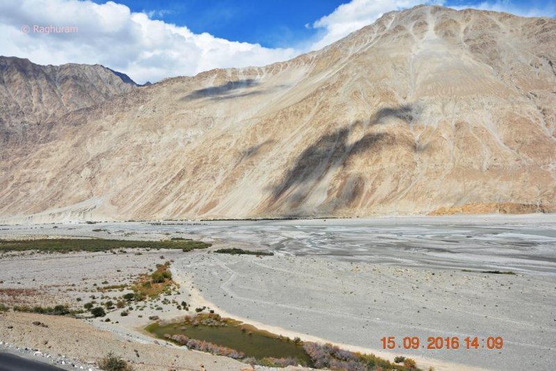
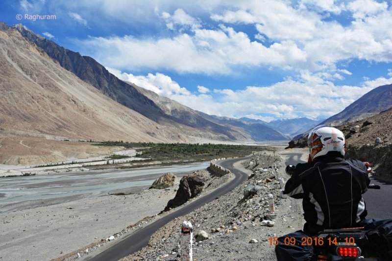
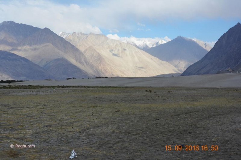
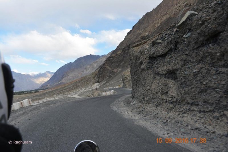
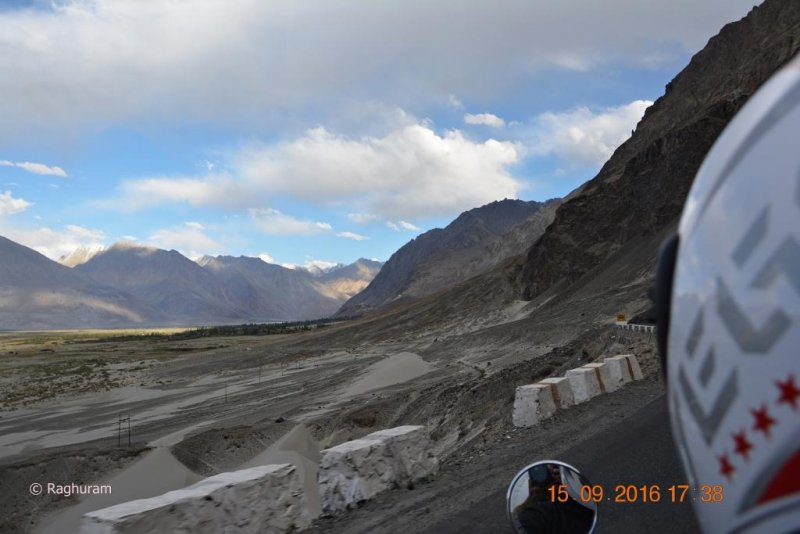
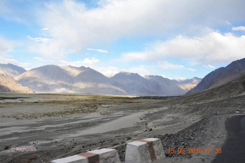
After an hour we were on our rides again; every short distance we found the formation and view of the mountains were changing dramatically as well the roads too – gut-wrenching and treacherous at some stretches and well laid breezy ones on the other. Every time when we stopped and looked back, we could see snake like roads mapped on brown mountains and every image you captured will be the best in your album.

DSC_0339.JPG
DSC_0340.JPG
DSC_0341.JPG
DSC_0342.JPG
DSC_0343.JPG
DSC_0344.JPG
DSC_0345.JPG
DSC_0346.JPG


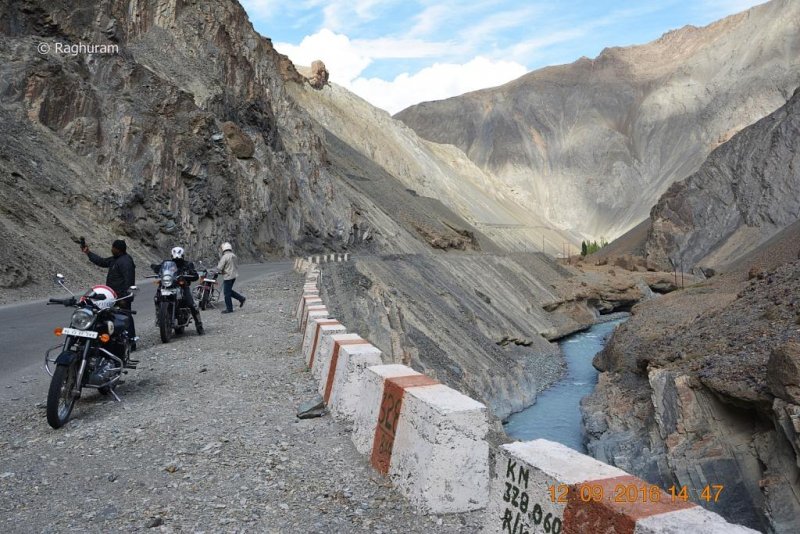
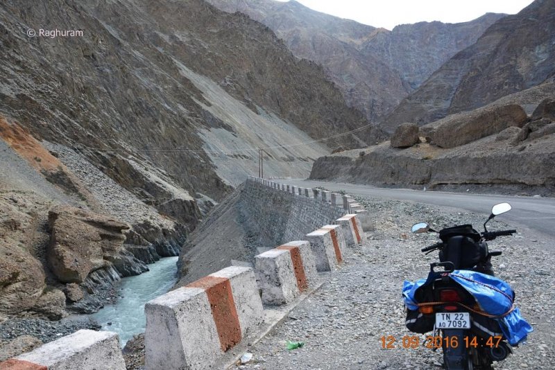
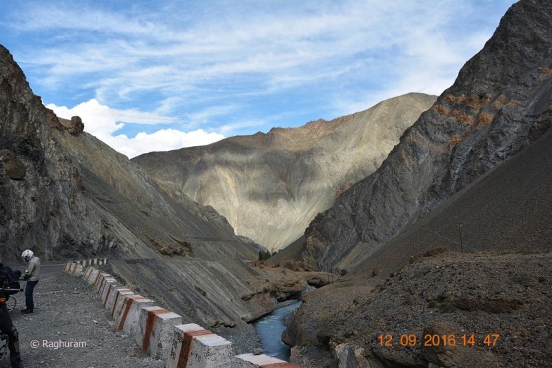
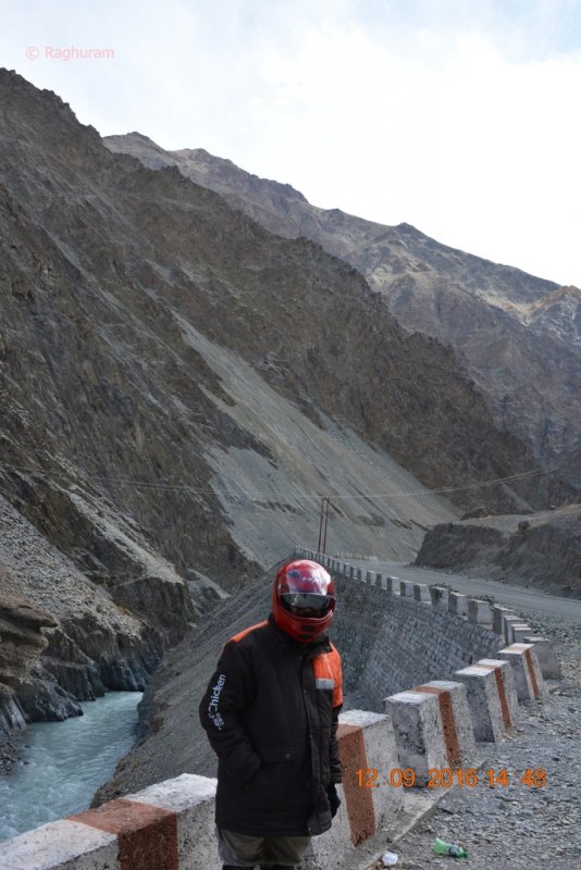
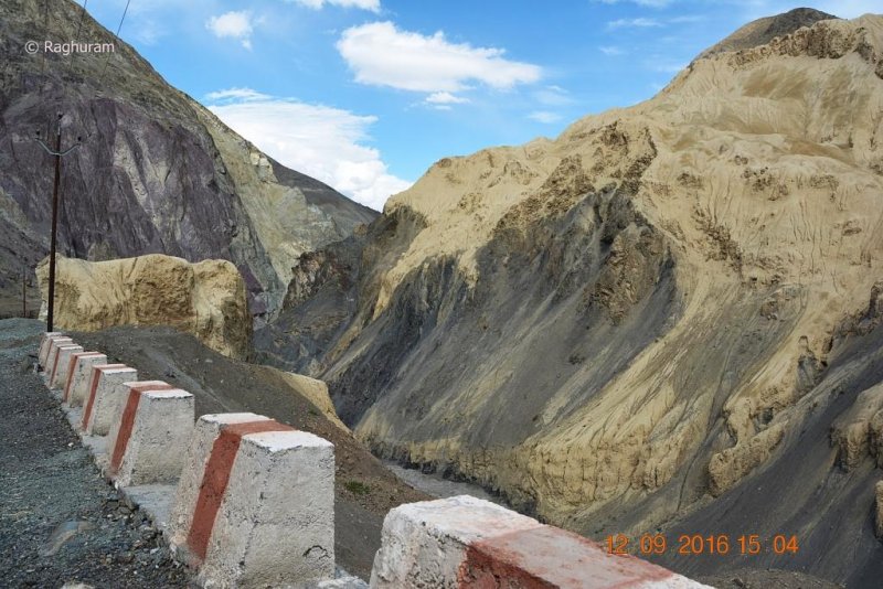
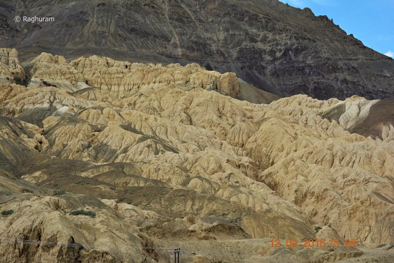
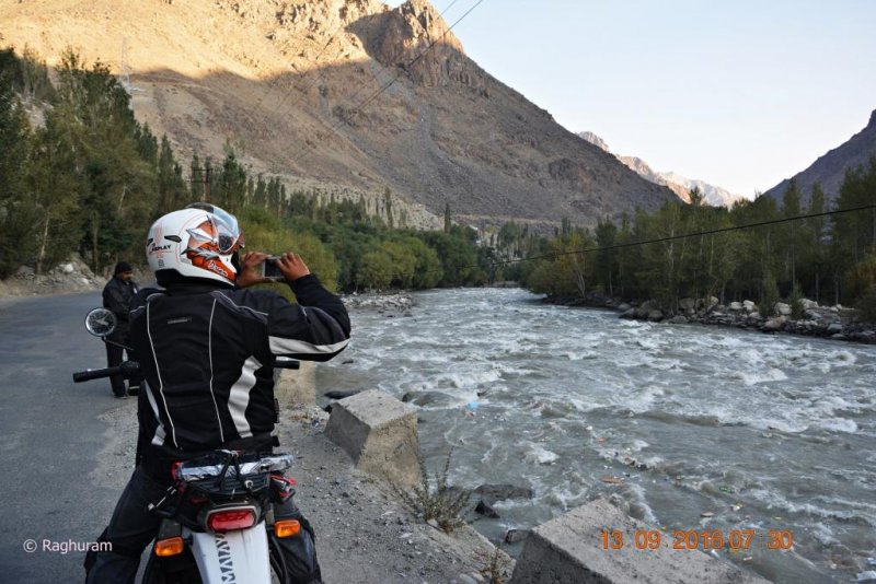
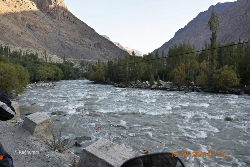
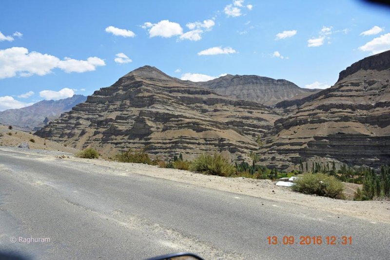
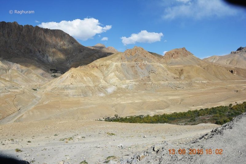
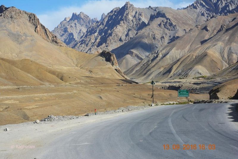
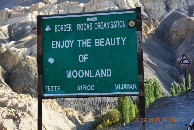
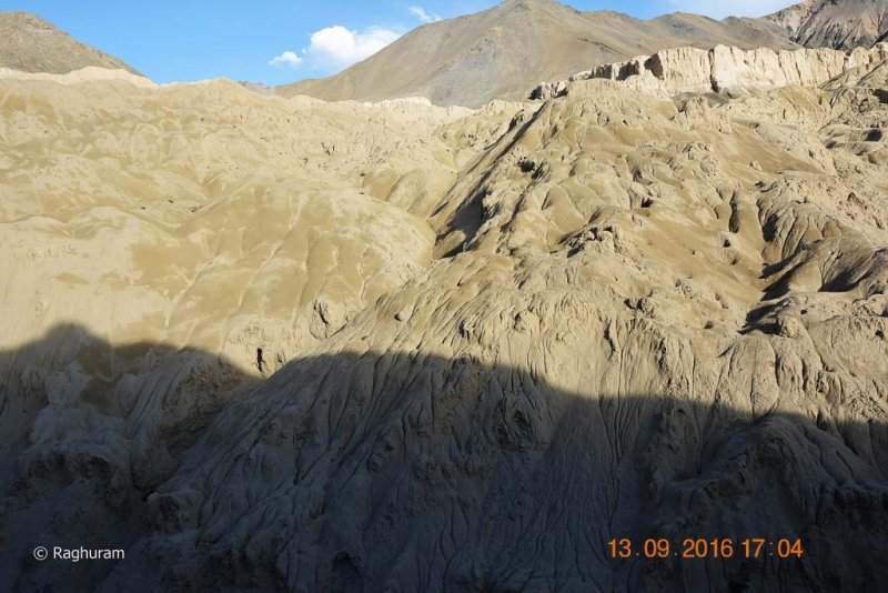
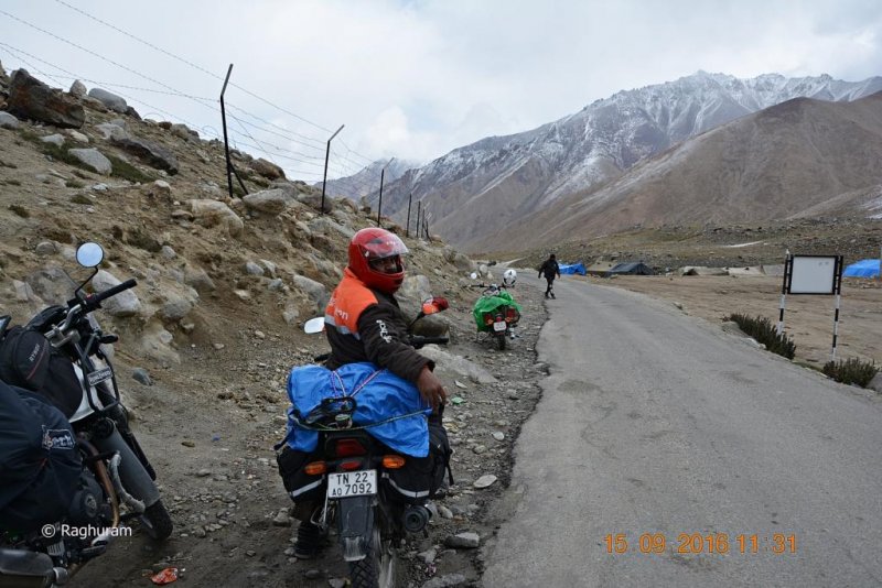
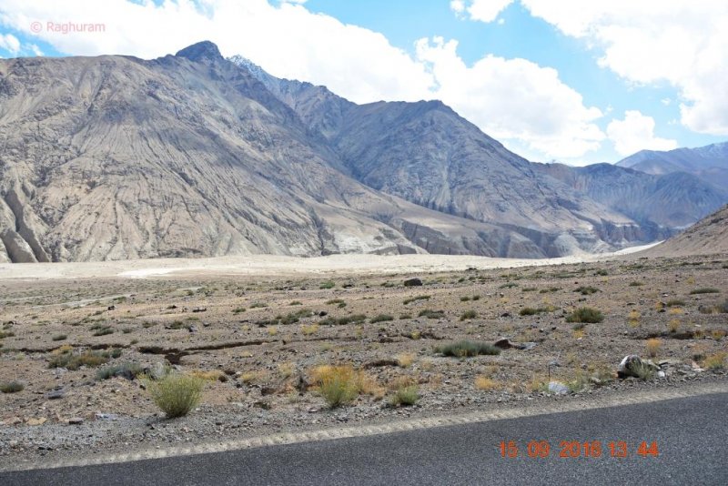
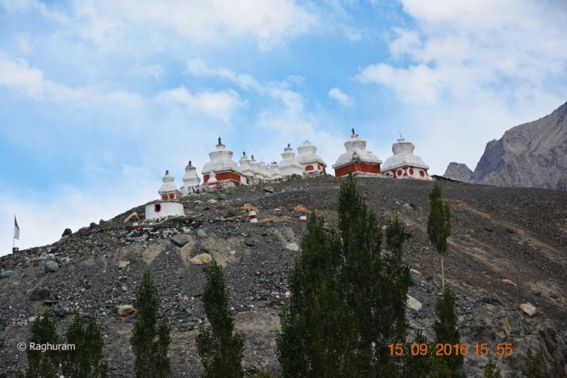
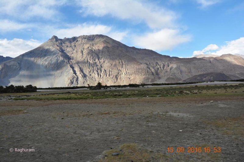
The ride went on & on by the river Indus alongside. At one point stopping was inevitable by the sight of the stunning “Moon land” as we were approaching Lamayaru.

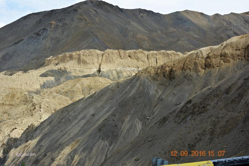
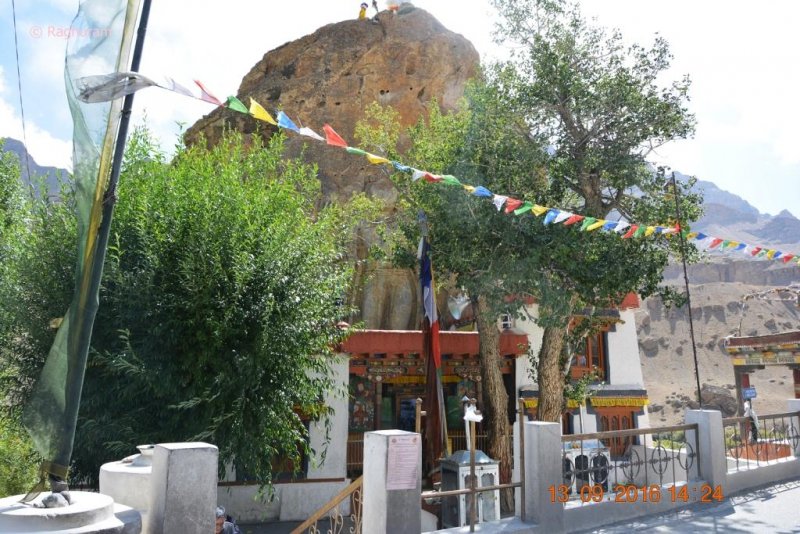
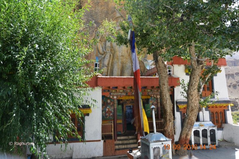
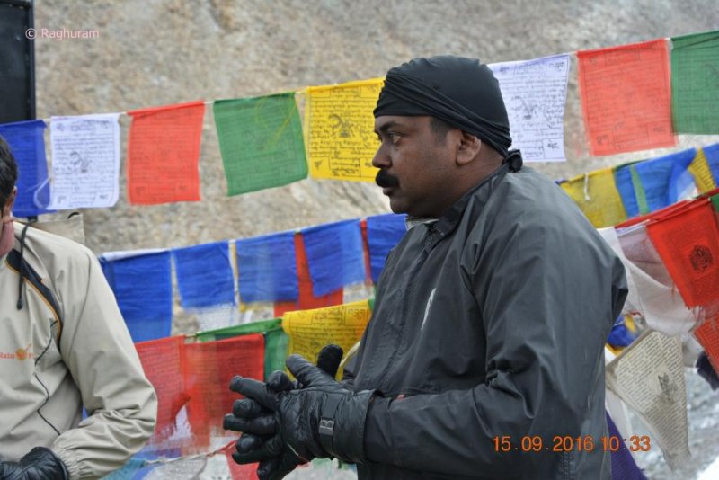
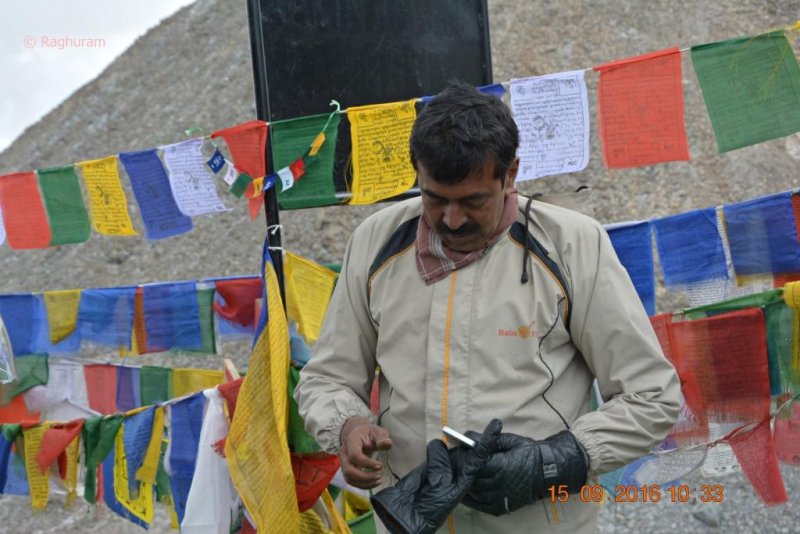
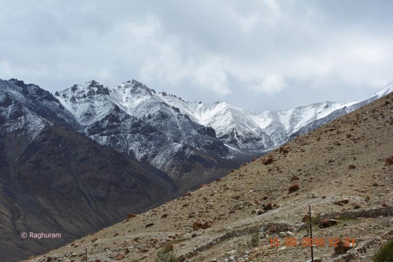
Lamayaru is popularly known as moon land by the locals due to its unique land surface which closely resembles the surface seen on moon. The clear blue skies meet the rugged horizon of broken mud cliffs, creating an atmosphere of lunar surface which has a powerful impact on the first time viewer’s psyche. We were rather possessed by the beauty of those wonder cliffs for a few moments; had a short break there, thought we would stop there again on our way back to take some more pictures.

DSC_0347.JPG
DSC_0348.JPG
DSC_0349.JPG
DSC_0350.JPG
DSC_0351.JPG
DSC_0352.JPG
DSC_0353.JPG
DSC_0354.JPG
DSC_0355.JPG


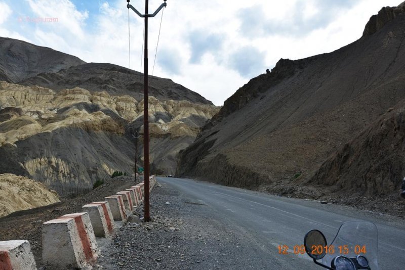
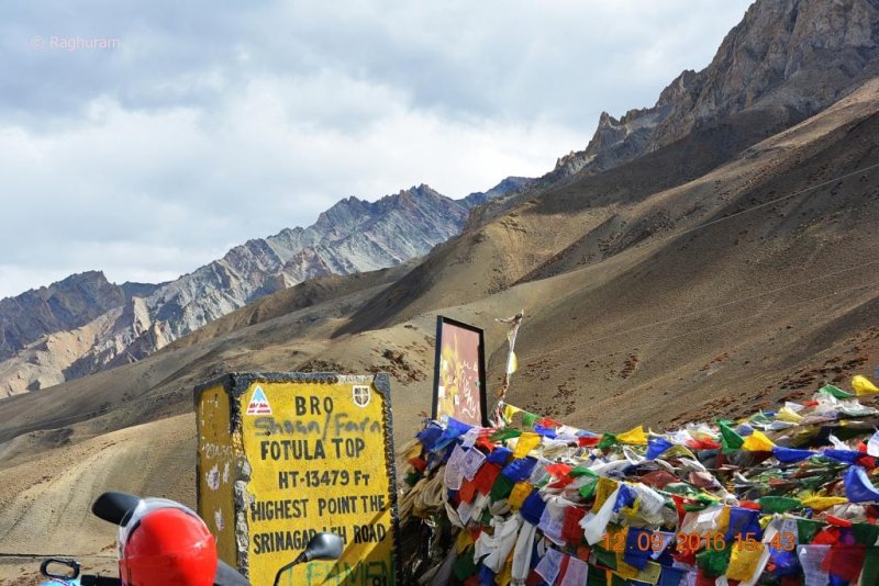
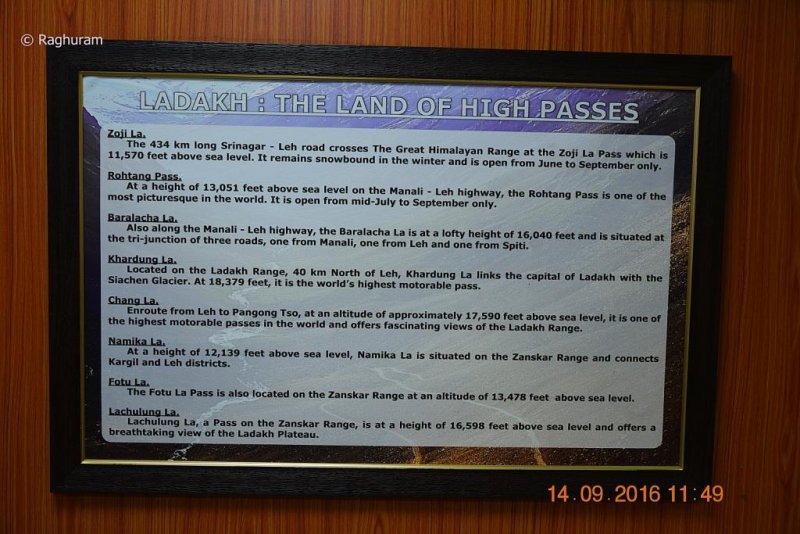
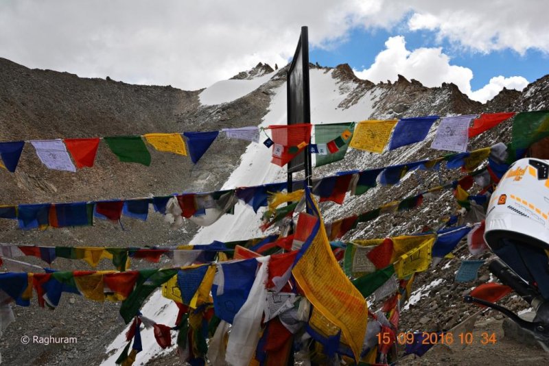
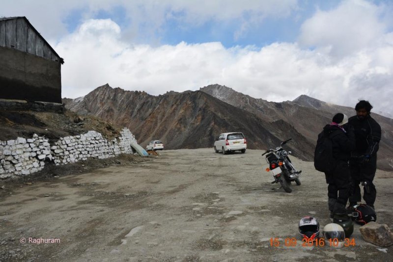
After ascending in a series of sharp and abrupt zigzags we reached ‘FOTULA TOP’; the distance from Lamayuru is 15 kms.

DSC_0356.JPG
DSC_0357.JPG
DSC_0358.JPG
DSC_0359.JPG
DSC_0360.JPG
DSC_0361.JPG
DSC_0362.JPG
DSC_0363.JPG
DSC_0365.JPG
DSC_0366.JPG

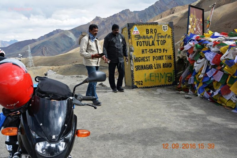
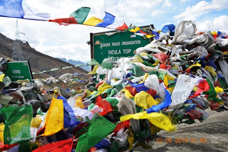
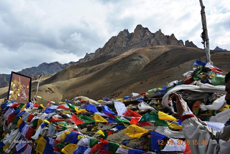
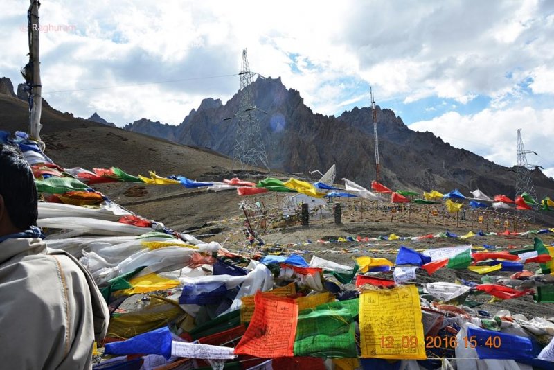
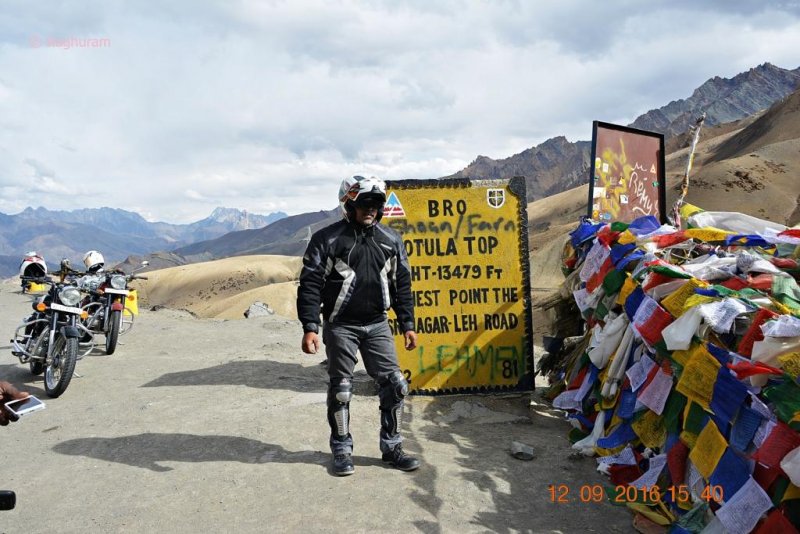
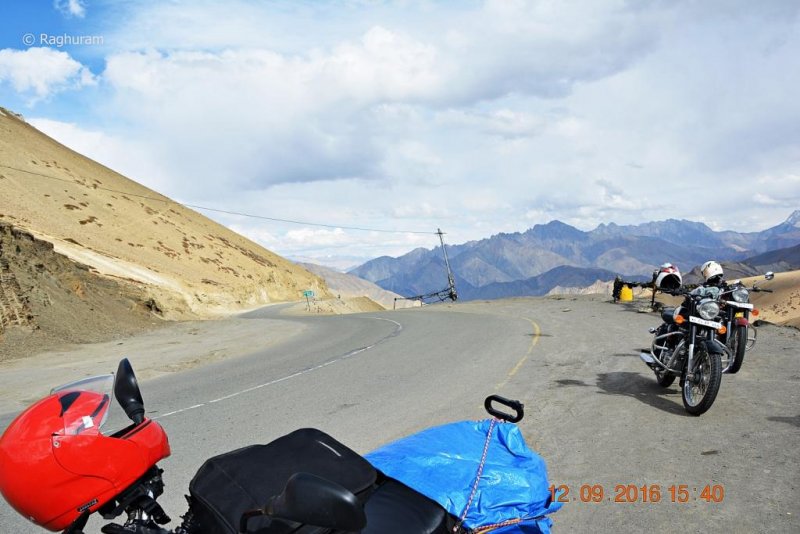
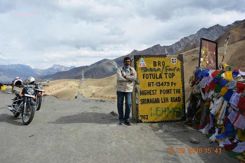
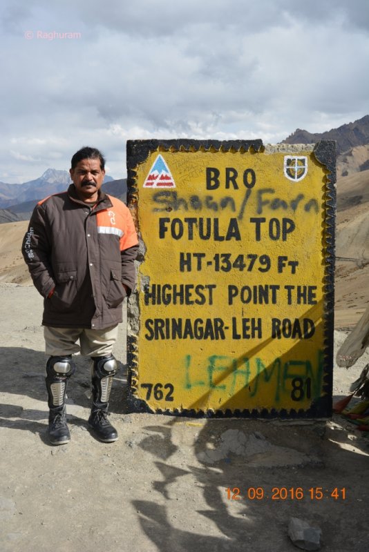
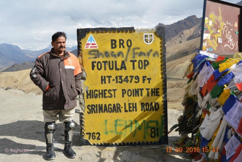
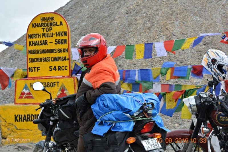
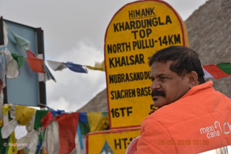
Fotula Top is at an altitude of 13479 feet above sea level and the highest mountain pass on Srinagar – Leh highway. Like any other passes in that region, Pray-flags were tied there also. We started from there after spending few minutes on a descending pace.

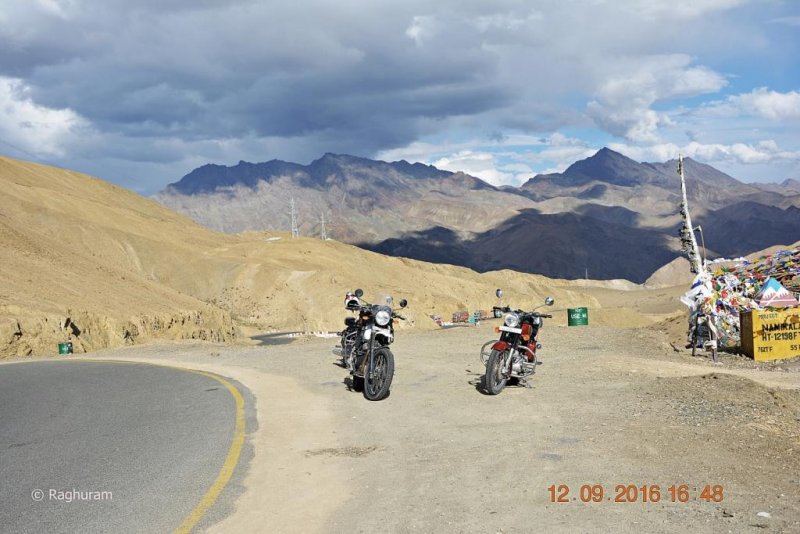
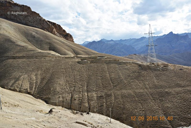
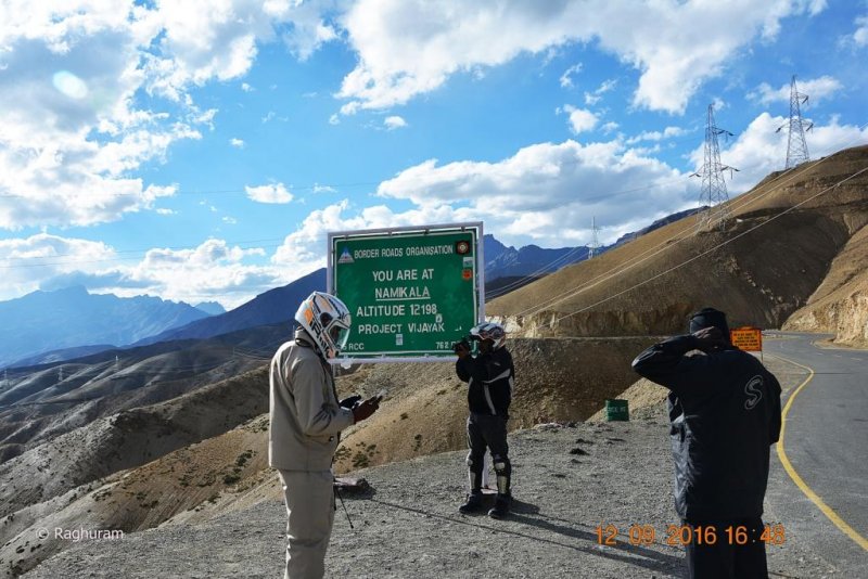
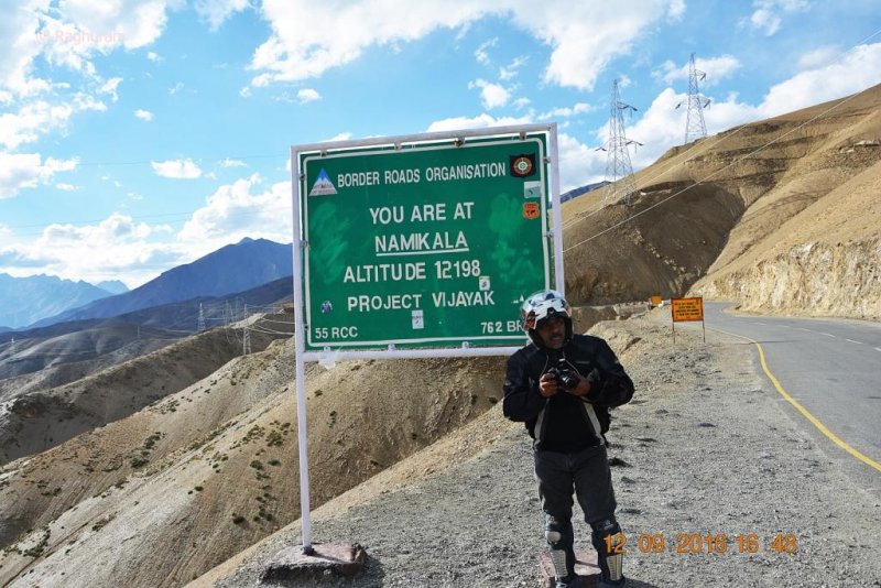
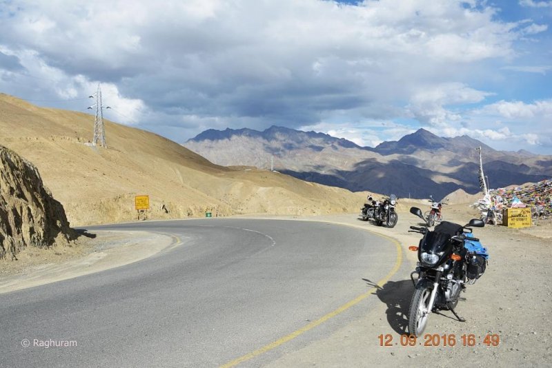
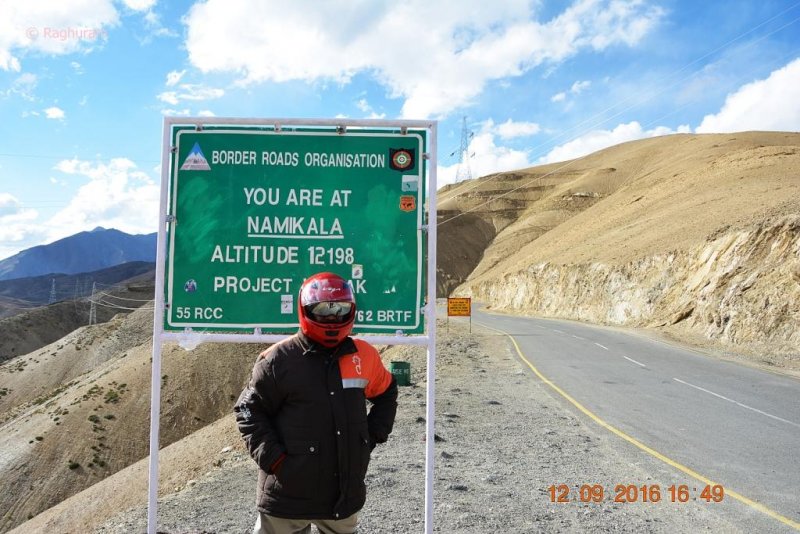
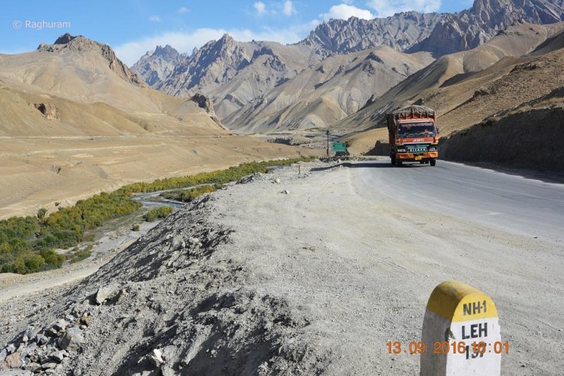
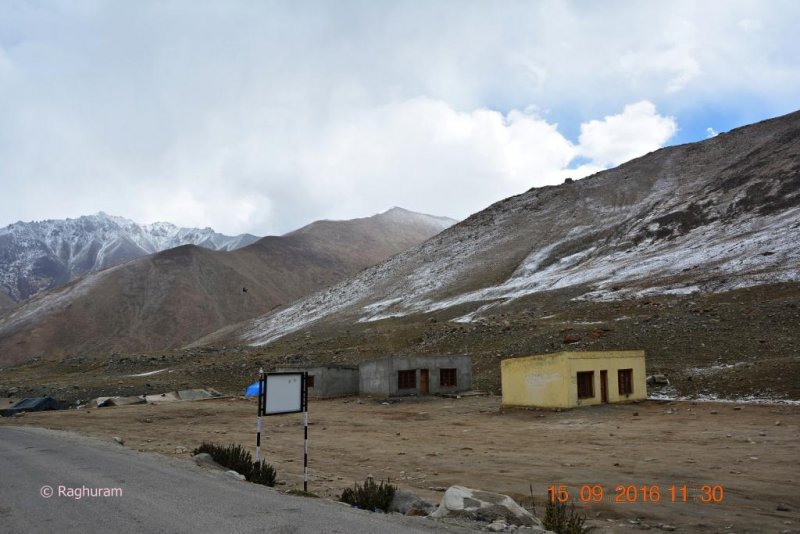
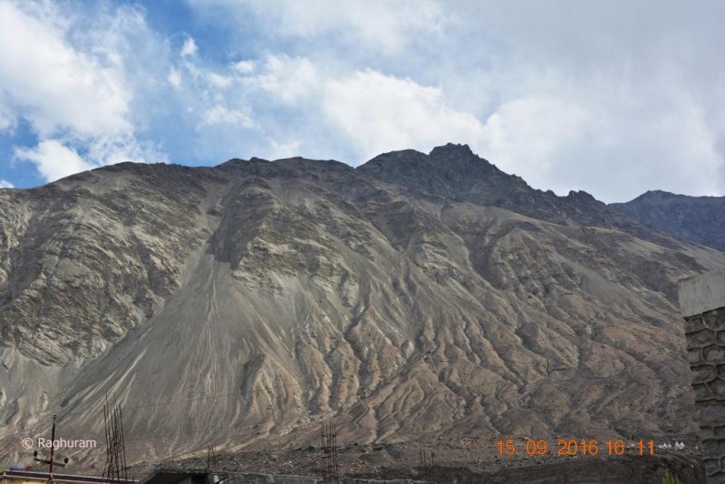
Covering a distance of 37 kms from Fotula top and passing through Haniskot we reached Namika La top at an altitude of 12198 feet ASL, the second highest pass between Leh and Manali; the time then was 4.45 pm.

DSC_0367.JPG
DSC_0368.JPG
DSC_0369.JPG
DSC_0370.JPG
DSC_0371.JPG
DSC_0373.JPG
DSC_0376.JPG
DSC_0377.JPG
DSC_0378.JPG
DSC_0379.JPG
DSC_0380.JPG
DSC_0381.JPG
DSC_0382.JPG
DSC_0383.JPG
DSC_0384.JPG
DSC_0385.JPG
DSC_0386.JPG
DSC_0387.JPG

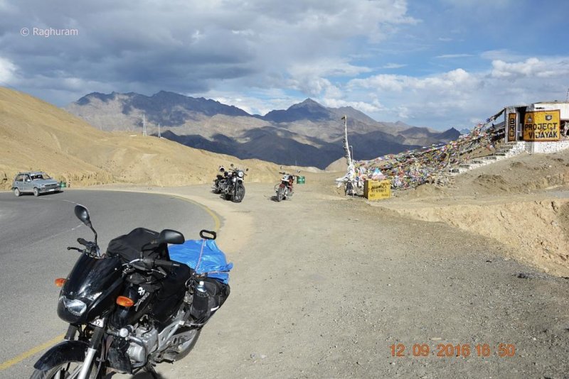
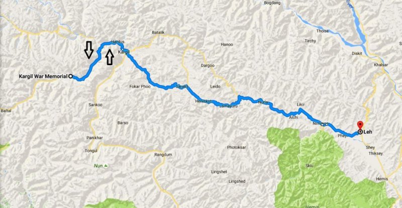
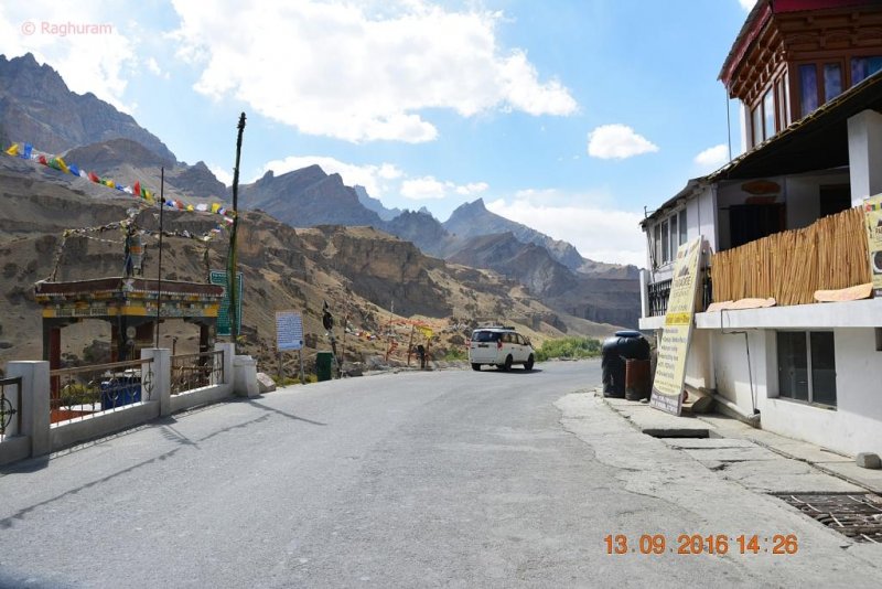
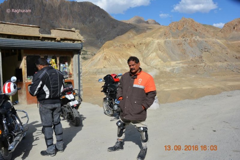
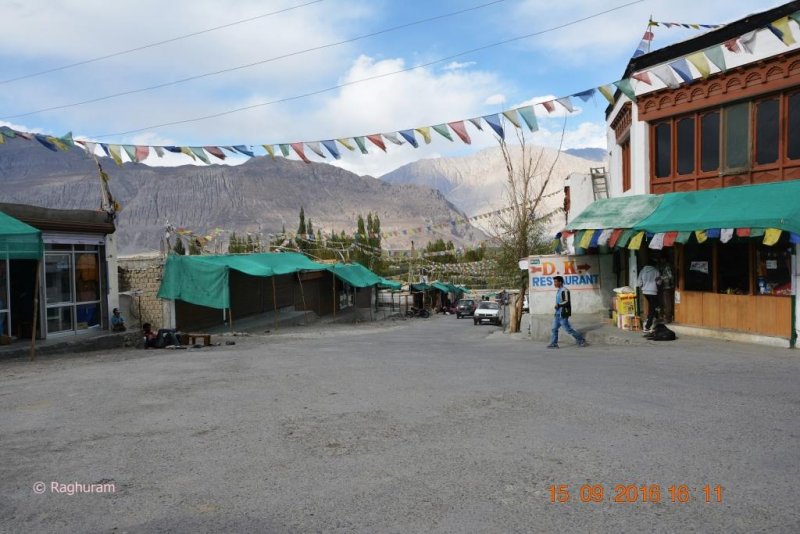
That was our last stop to capture pictures on the day until we reached Kargil at 6 pm, at a distance of 52 kms from Namika la en route Mulbekh and Chhoolatsay. Before reaching the town we had the fuel top up at a petrol station.

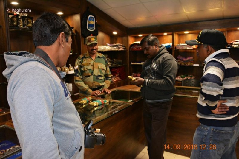
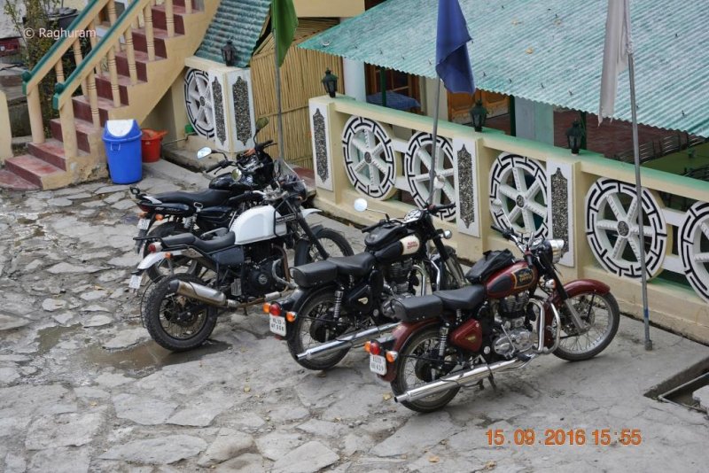
We were searching for Hotel D’Zojila where Dr Rajeev and Adv Suresh were staying during their last visit and finally located it. We were haggling over the cost for its standards until they gave us some discount. The rooms were basic and comfortable and perfect for a night stay; the food served at the restaurant was pretty good and moderately priced.

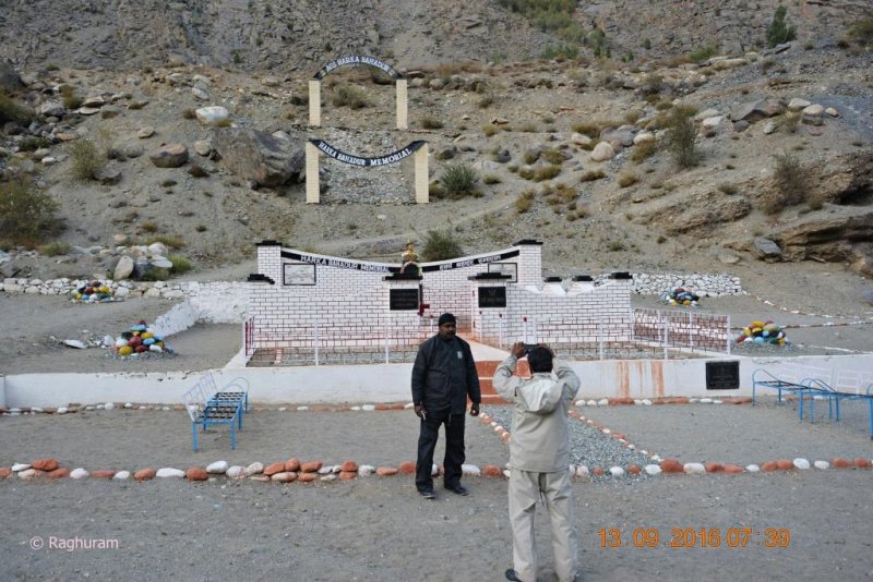
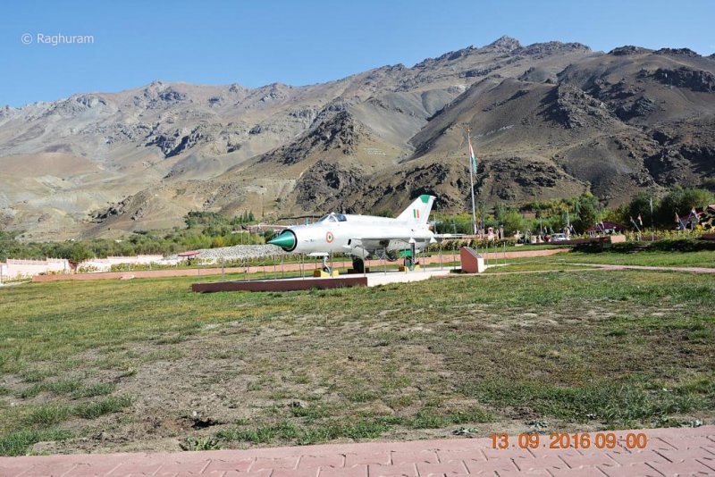
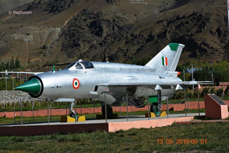
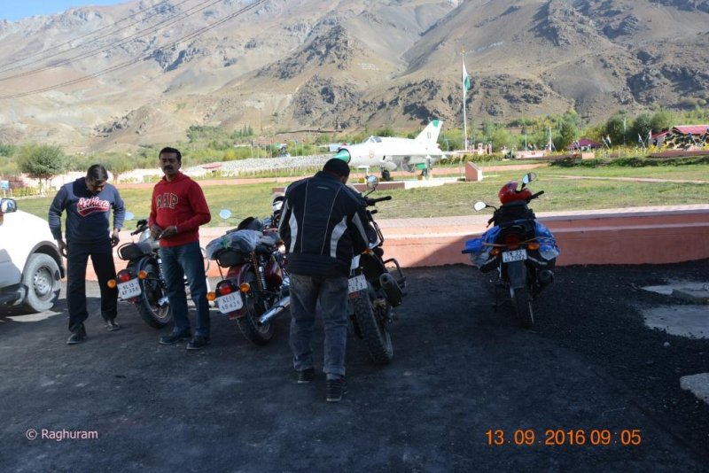
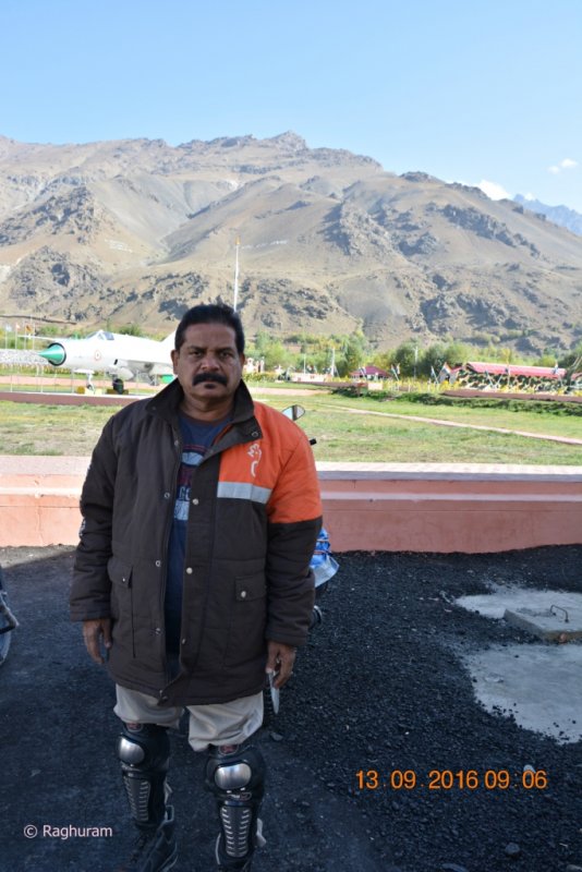
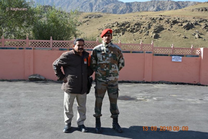
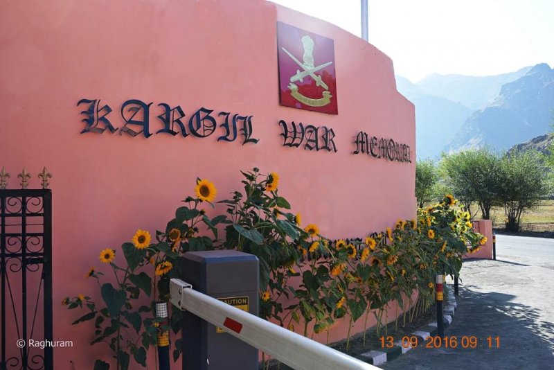
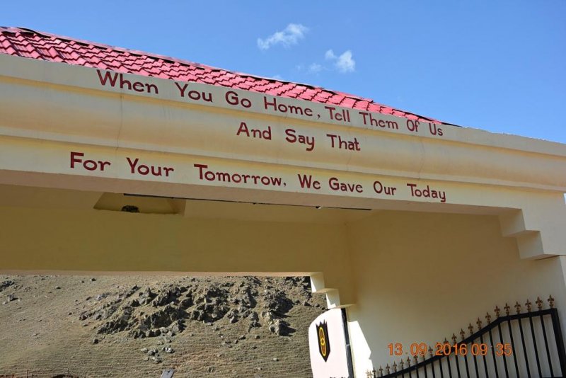
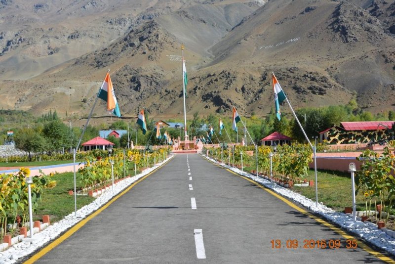
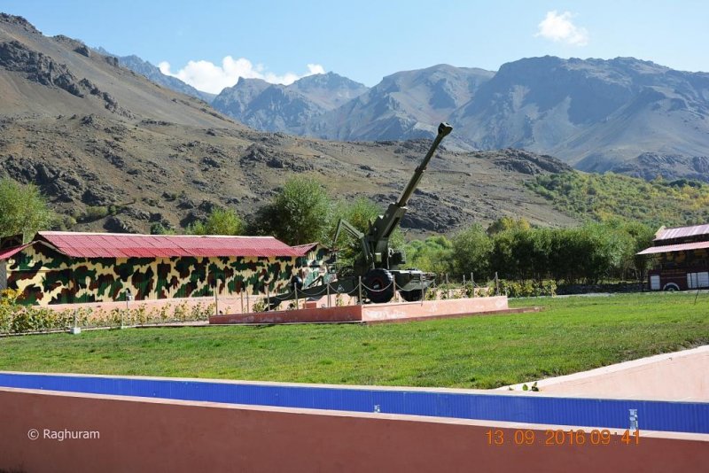
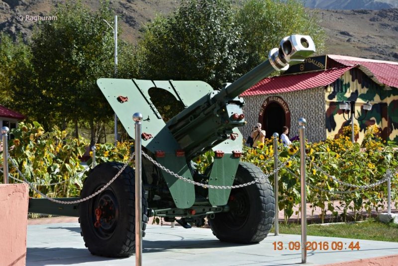
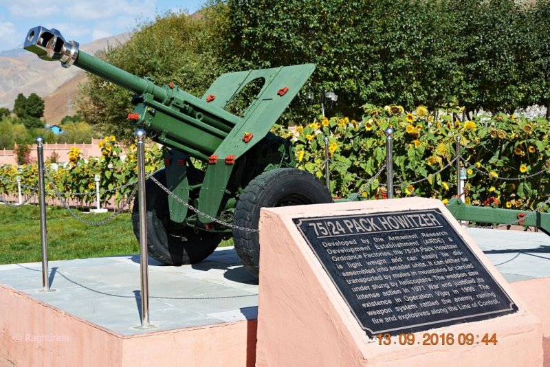
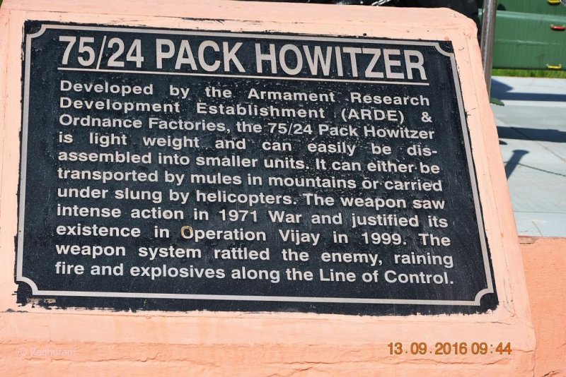
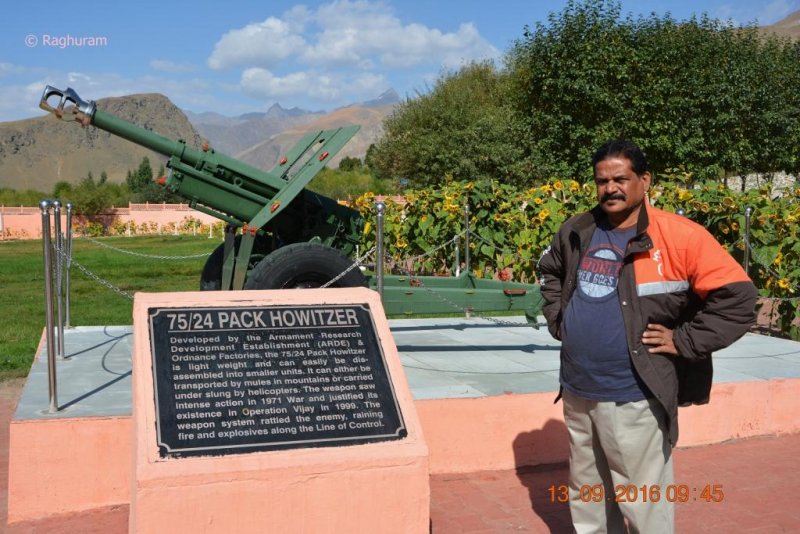
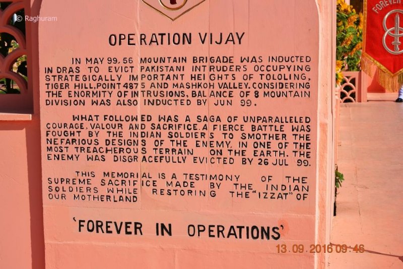
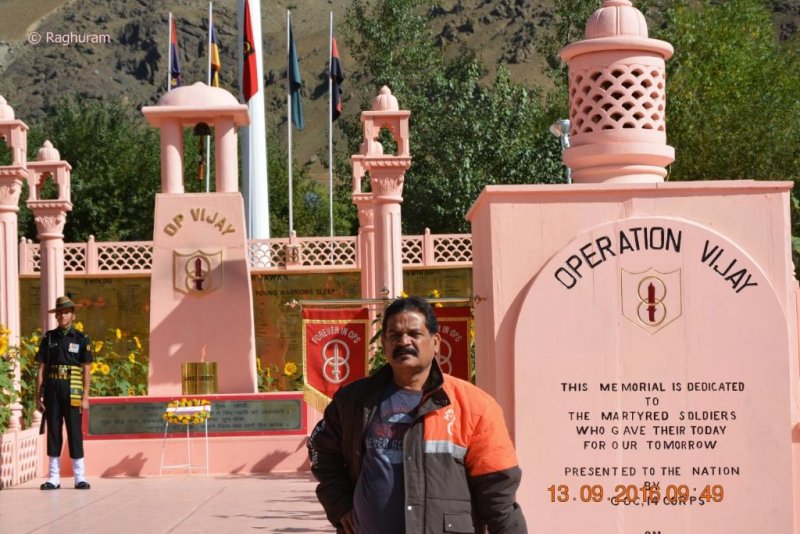
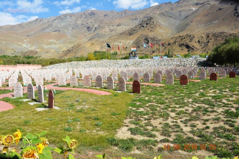
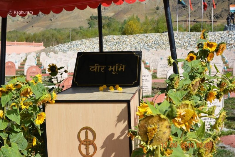
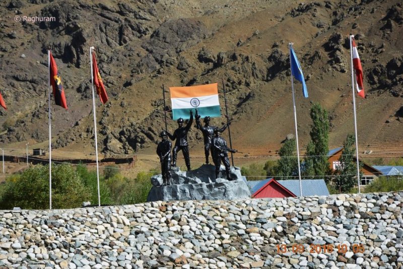
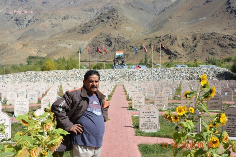
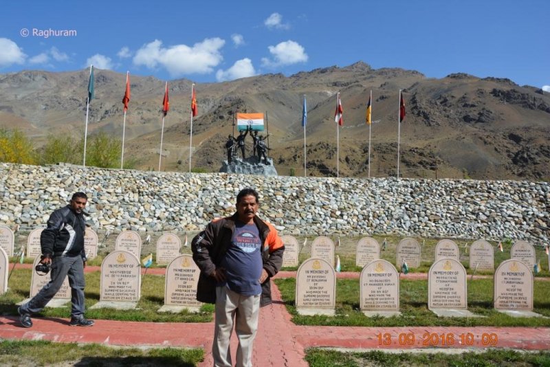
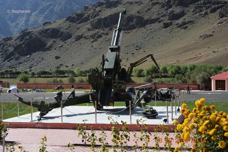
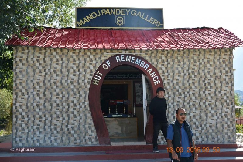
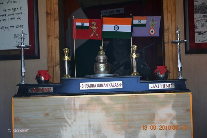
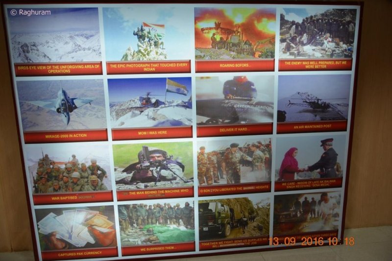
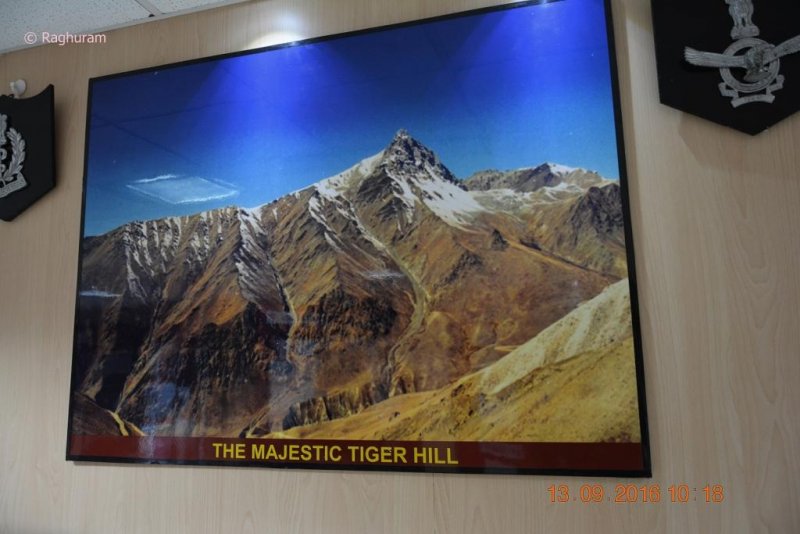
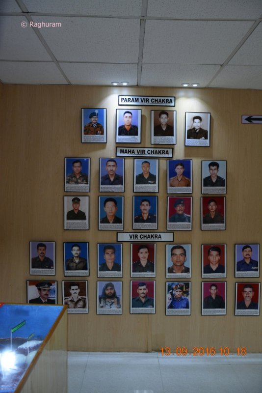
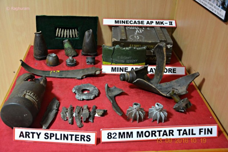
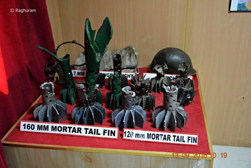
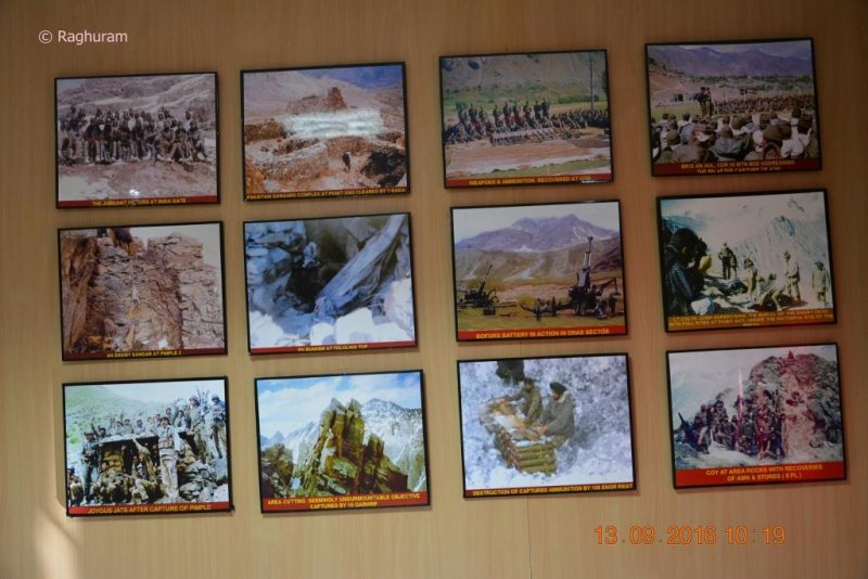
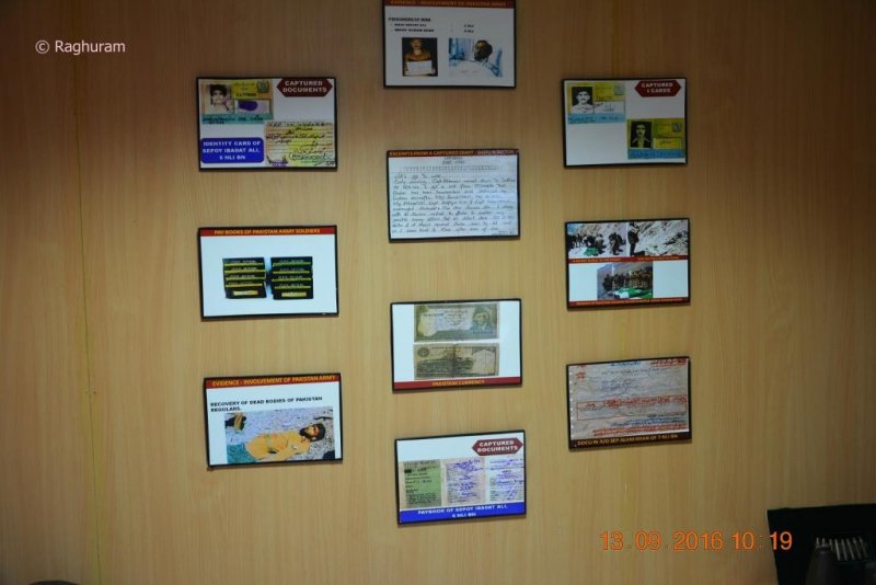
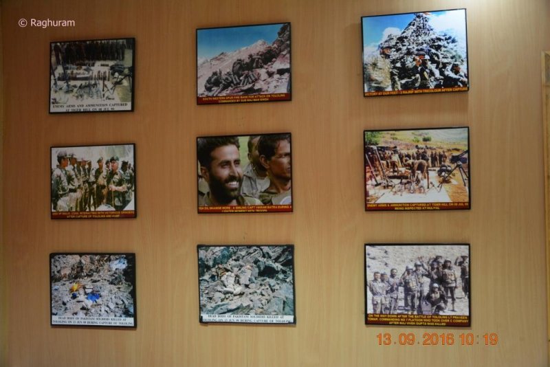
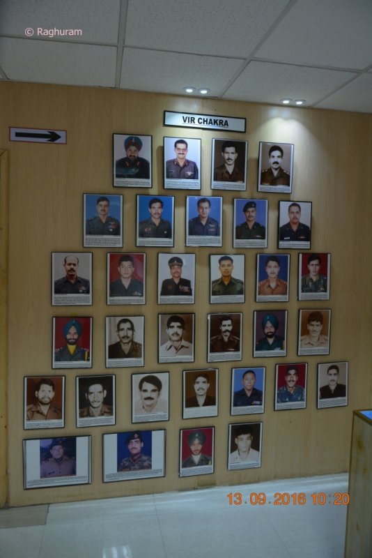
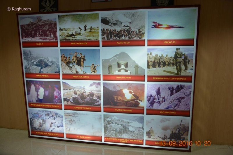
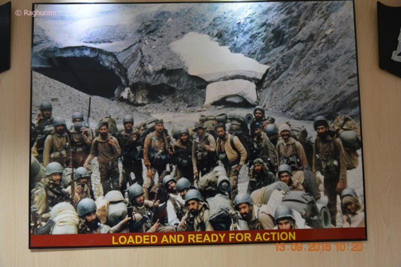
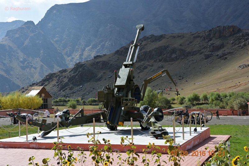
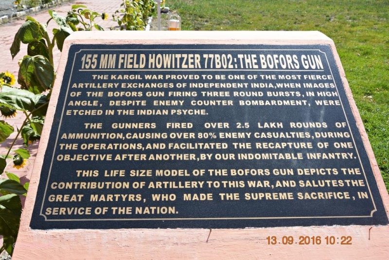
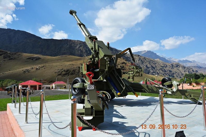
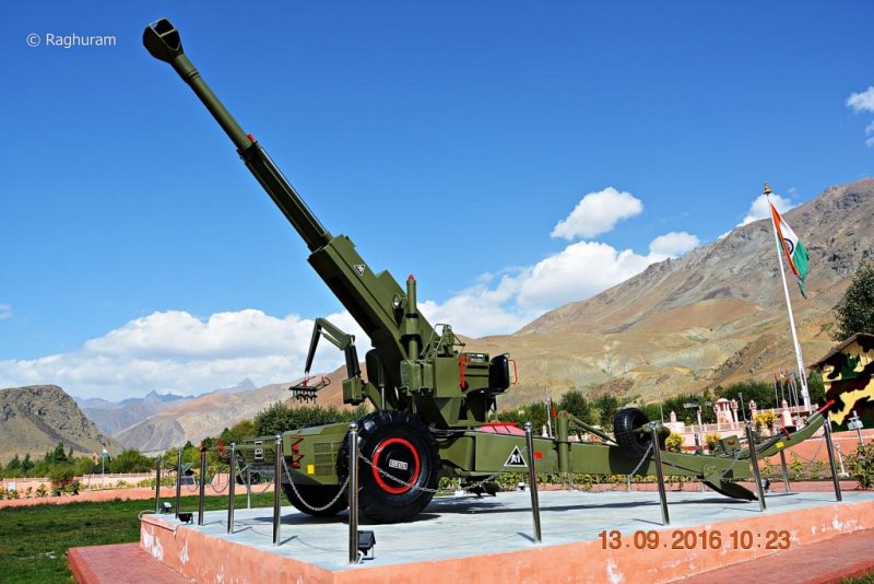
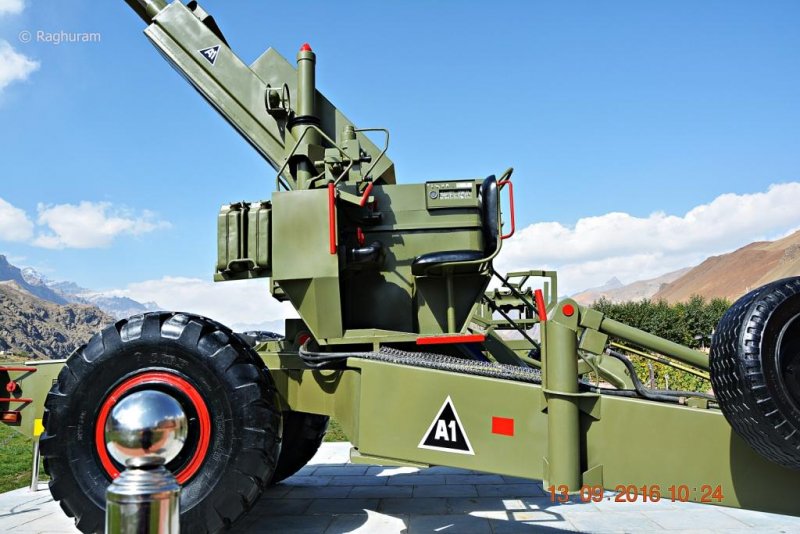
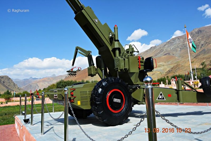
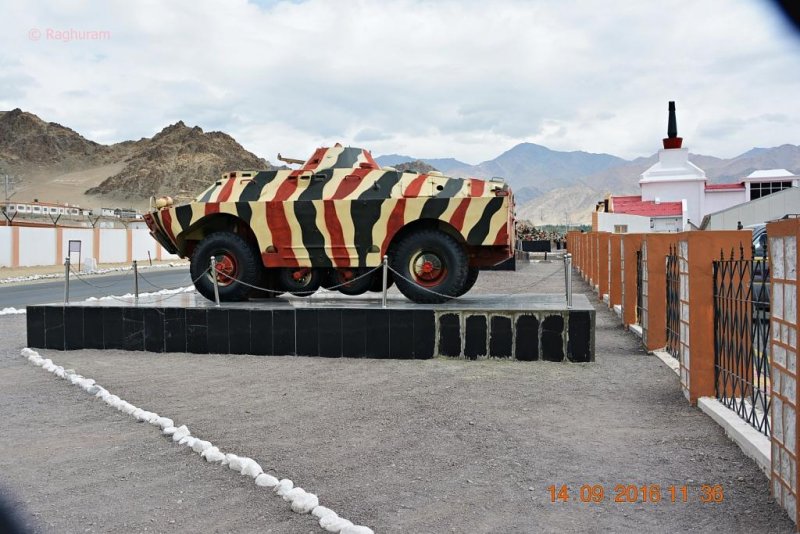
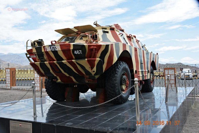
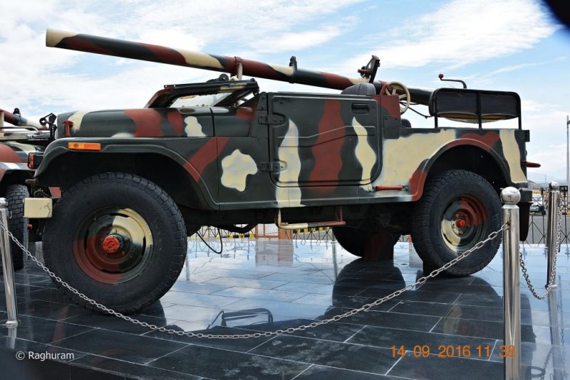
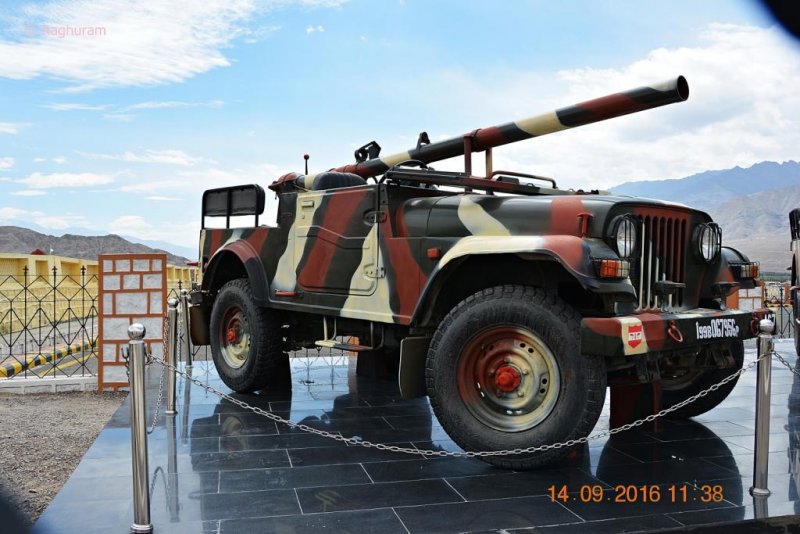
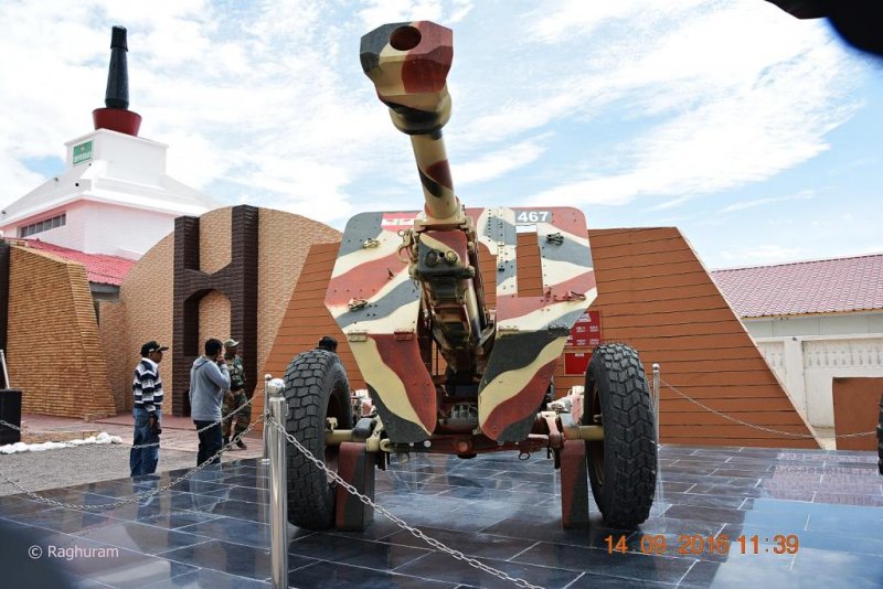
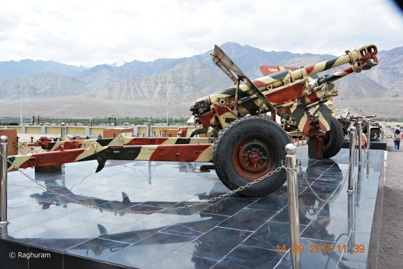
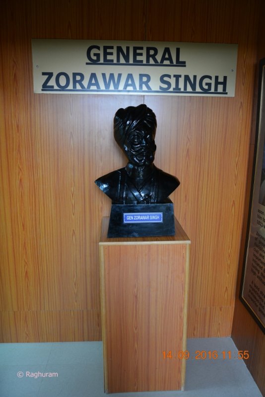
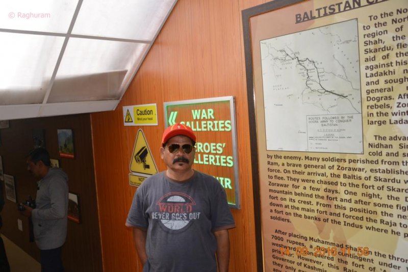
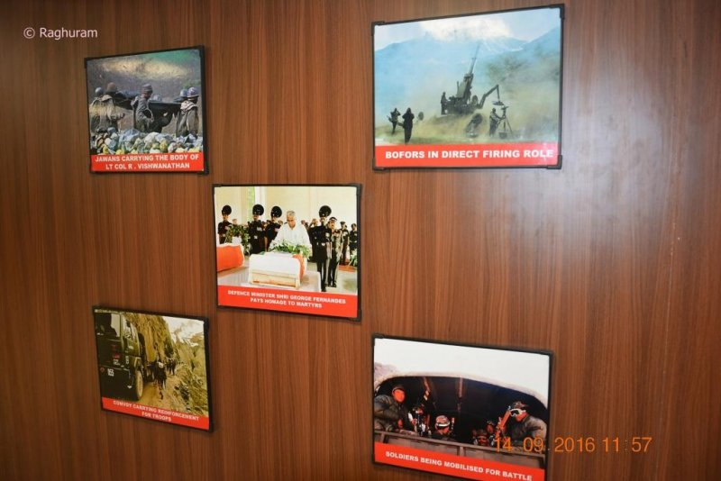
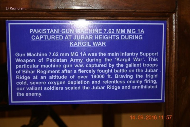
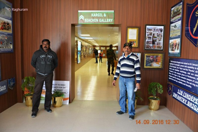
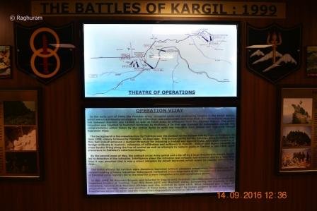
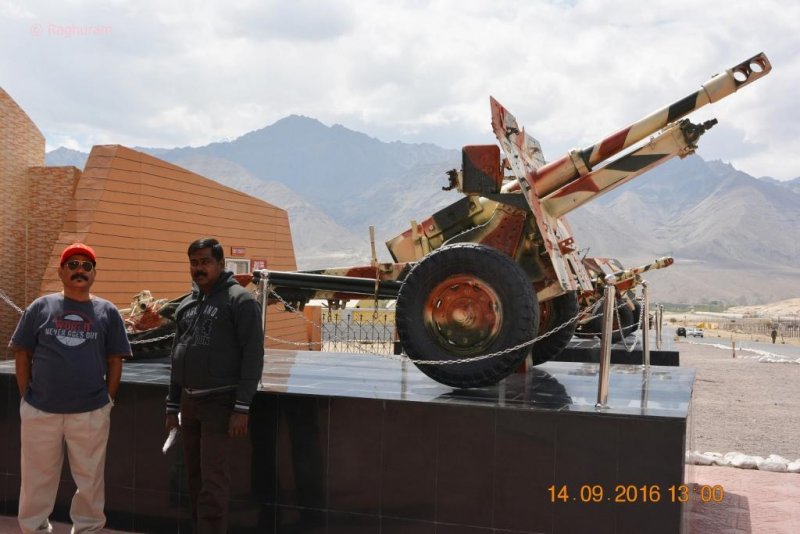
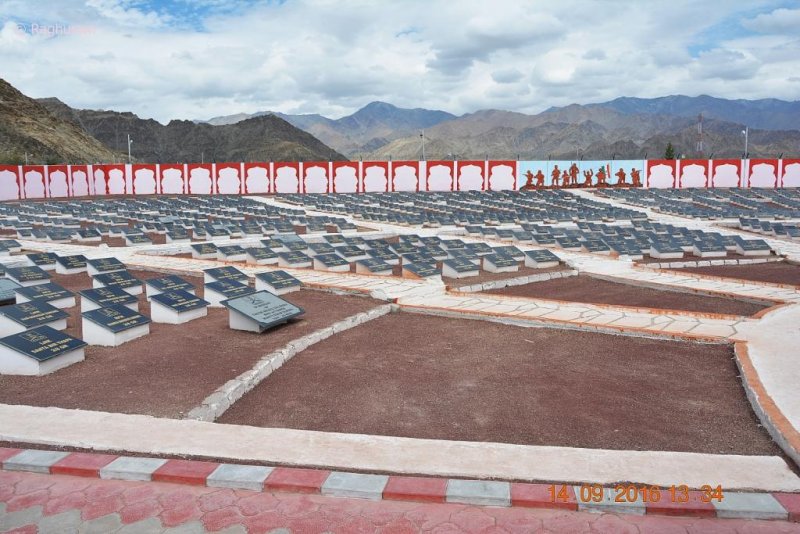
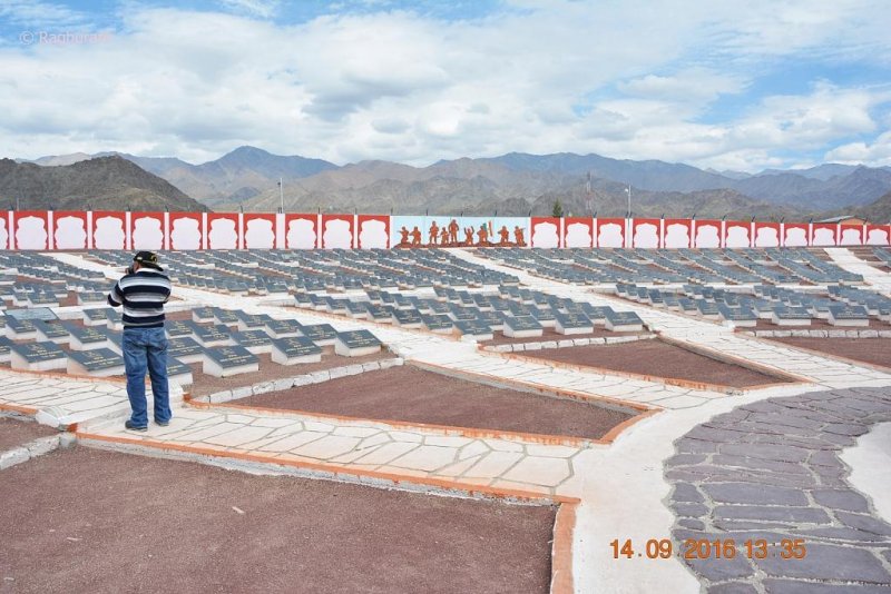
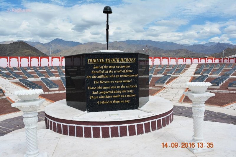
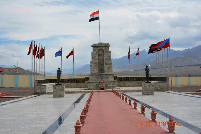
Kargil War Memorial and more - stay tuned for the next episode

 
Thread Starter #19
Joined
Apr 24, 2012
Messages
1,384
Likes
807
Location
Kerala
Ram, Great travelogue. I am spell bound by the great narration and beautiful snaps. Waiting for the next episode.
Thank you so much for the comment [clap]

The process of making the travelogue and posting it with the pictures is somewhat cumbersome. However I am doing it as fast as possible.
 
Thread Starter #20
Joined
Apr 24, 2012
Messages
1,384
Likes
807
Location
Kerala
Travelogue (Episode 8)

The great Himalayan Expedition on motorbikes

Day – 9

13th September, 2016 – Kargil > Drass > Leh – 325 kms


‘It was a speech full of high-minded expressions of patriotic responsibility’ – more on video
‘The fiercely patriotic Indian army is as brave and committed as any army in the planet’.


Last evening we reached the hotel and checked-in at 7 pm; the stay was comfortable.
As per our day’s itinerary we would be heading towards Kargil War Memorial first, at a distance of 52 kms.

DSC_0388 a.jpg

We all were ready by 7 am, fastened our baggage to bikes and hit the tracks at 7.15 am. The roads were in a moderate condition alongside Suru River and the weather was cool and pleasant as the Sun had just risen. As usual the mountain views became increasingly attractive; we stopped at many places and took snapshots.


https://www.youtube.com/watch?v=Z2Jgci0rOBk&index=13&list=FLtUxSX5SnpboVPR9Cr-DrNQ


DSC_0388.JPG
DSC_0390.JPG
DSC_0391.JPG


A few kms away we stopped at Harka Bahadur Memorial built in memory of the Legend who saved Kargil, Subedar Harka Bahadur Rana.

DSC_0392.JPG
DSC_0393.JPG
DSC_0394.JPG
DSC_0395.JPG
DSC_0396.JPG
DSC_0397.JPG
DSC_0398.JPG
DSC_0400.JPG
DSC_0401.JPG
DSC_0402.JPG

July 26th is celebrated across India as the Kargil Vijay Diwas to commemorate the glorious victory of India over the Pakistani forces in 1999.

What about the forces themselves? What do they celebrate?


When it comes to Kargil, there is only One Hero – in fact a LEGEND who stands the tallest. As far as the forces are concerned there is One Giant who along with his brave comrades literally saved Kargil for India, and that did not happen in 1999.

It happened in 1948, during independent India’s first war.

We are proud to present the story of a Gorkhali legend who has continued to inspire generations of soldiers serving in for the Indian army in Kashmir.

INDEPENDENCE BLUES
Barely few months after independence, Pakistan invaded India via Kashmir with overwhelming number of forces, and such was the disadvantage our troops were in, that India was on the verge of losing entire Kargil region to Pakistan.

The main problem was that our troops could not reach the battlefield due to lack of roads, and they had to reach Leh via Zojila , Drass, and Kargil. Despite poor facilities and equipment, hard work by our Engineers helped in moving the Tanks to reach up to the Zojila pass - in what is called THE BATTLE FOUGHT ON DONKEY TRACKS - But it was still a long way from the actual battle field.

GORKHALIS ON THE MARCH
As in Kargil in 1999 when the 1/11 Gorkhas were the First battalion to be deployed for Kargil, back in 1948 it was the 1/5 Gorkha Rifles under the command of (then) Lt. Col Anant Singh Pathania, who was incidentally the first Indian officer to command the Gorkha Rifles and win a Military Cross, began moving northwards in the direction of Kargil.

During the course of the 1948 war, the most fearful battle was fought for the then Khera Bridge which connects Kargil to the rest of India and it was vital to both the sides from strategic, military and geopolitical aspects.

Since the Pakistanis had captured the Kargil area, they were well entrenched in the area with superior firing positions and well supplied armory. On the other hand the Indian army had been on a move for a while and the supplies were not as regular, also they were in inferior positions which exposed them to firing by Pakistani troops.

THE BATTLE AT KHERA BRIDGE
The 1/5 Gorkha Rifles were engaged by a strong force of Pakistani defenders at Khera Bridge over the river Shingo. The battle was so fierce and the Indian troops were so disadvantaged that at one stage of the war the capture of the bridge seemed to be by all means impossible and unlikely. Until one Gorkha soldier decided that loss or withdrawal was simply not an option.

The main problem for the Indian troops was that, the enemies were too well set and they could not keep on fighting the enemy from a distance, they needed to take the fight to the enemy or give up. The battle was fierce and most of the troops guarding the bridge were American trained Pak soldiers with heavy machine guns.

Despite all the odds young Subedar Harka Bahadur Rana and his valiant men of 1/5 GR managed to cross the Shingo River, take the fight to the enemy in the positions where they had felt invincible, and beat them into surrendering or retreating.

SUPREME SACRIFICE
Sub. Harka Bahadur and many of his friends died in the operation but the Gorkhas marched ahead till they fought up to Kargil. As one of the pictures will show, before Sub Harka Bahadur and his friends decided enough was enough, it was Pakistan on the other side of the bridge, now the border is more than 5kms away.

Given that so many of our brave hearts have given their supreme sacrifice for our motherland in Kashmir, nowhere in Ladakh or entire Kashmir will you see a memorial solely dedicated to a single person. The memorial dedicated to Sub Harka Bahadur is an exception.

Sub Harka Bahadur Rana earned that rarest of the rare honour not only due to his valour and dedication for our motherland, but also for that rare indomitable spirit which turned the course of war and helped in conjoining Kashmir with India forever.

WE REMEMBER
Lt. Col. Anant Singh Pathania who commanded the mission was decorated with Mahavir Chakra, and Late Subedar Harka Bahadur Rana won Military Cross for his bravery and exploits. Today a new bridge has been built by Indian Army and is known as Harka Bahdur Rana Bridge.

In Military circles, it is said that the battle waged by Col. Phatania, Sub. Harka Bahadur Rana and their men of 1/5 Gorkha Rifles were one of the hardest battles ever fought.

While others chose to ignore or forget our brave hearts, we refuse to forget the real Legends of Kargil - like Harka Bahadur, without whom there would be no Kargil in India.

Jai Mahakali!! Ayo Gorkhali!!

[This article was published earlier in The DC, and has been re-posted as ‪#‎KargilVijayDiwas‬ Special] – Courtesy Indian Gorkhas

We left the place after few minutes and reached the war memorial at 9 am. A separate parking lot was there adjacent to the memorial. Entry was free and no bags of any kind were allowed inside.

DSC_0403.JPG
DSC_0406.JPG
DSC_0407.JPG
DSC_0408.JPG
DSC_0410.JPG
DSC_0411.JPG
DSC_0412.JPG
DSC_0413.JPG
DSC_0415.JPG
DSC_0416.JPG
DSC_0417.JPG
DSC_0418.JPG
DSC_0419.JPG
DSC_0420.JPG
DSC_0421.JPG
DSC_0422.JPG
DSC_0423.JPG


Since we started in the early hours of the day, we were yet to have our breakfast; we didn’t find a place on the way too. As soon as we entered the memorial we saw the cafeteria inside and a souvenir shop adjacent to it. But, the only item available there, was momos and we had to compromise with it.

DSC_0424.JPG
DSC_0425.JPG
DSC_0426.JPG

Momo is a type of steamed bun with some form of filling. Momo has become a traditional delicacy in Nepal, Tibet and among Nepalese/Tibetan communities in Bhutan, as well as Sikkim state and Darjeeling district of India. It is one of the most popular fast foods in Nepal. Momos have also spread to other countries like United States (some parts), UK and India.

After the breakfast we went to the souvenir shop, made some purchases like T shirts, caps and key-chains etc. It was told that the proceeds would go to the welfare of family members of those who lost their life during the military operations; we were more inclined towards the motto than a shopping.

Dras War Memorial, also known as the Vijaypath, is a war memorial built by the Indian Army, located in Dras, in the foothills of the Tololing Hill. The memorial is located about 5 km from the city centre across the Tiger Hill. It is located on the Srinagar-Leh National Highway 1D. The memorial is in the memory of the soldiers and officers of the Indian Army who were killed during the 1999 conflict between India and Pakistan. The conflict later became known as the Kargil War. The memorial has a huge epitaph with names of all the officers and soldiers who died in war. Kargil Vijay Diwas is celebrated on 26 July every year at the memorial simultaneously the Prime Minister of India pays tribute to the soldiers at Amar Jawan Jyothi at the India Gate, New Delhi.
The main attraction of the whole memorial is the Sandstone wall, in the open, which has the names of all the Indian army personnel, who laid their lives during the Kargil war besides there is also a souvenir shop. Visitors to the memorial can also see from there, some of the peaks that the Indian army captured back from Pakistan. A giant national flag, weighing 15 kg was hoisted at the Kargil war memorial to commemorate the 13th anniversary of India’s victory in the war

DSC_0427.JPG
DSC_0428.JPG
DSC_0429.JPG
DSC_0430.JPG
DSC_0431.JPG
DSC_0432.JPG
DSC_0433.JPG
DSC_0434.JPG
DSC_0435.JPG
DSC_0436.JPG
DSC_0437.JPG
DSC_0438.JPG
DSC_0439.JPG
DSC_0440.JPG
DSC_0441.JPG
DSC_0442.JPG
DSC_0443.JPG
DSC_0445.JPG
DSC_0446.JPG
DSC_0448.JPG
DSC_0453.JPG
DSC_0454.JPG
DSC_0455.JPG
DSC_0456.JPG
DSC_0457.JPG
DSC_0459.JPG
DSC_0460.JPG
DSC_0461.JPG
DSC_0462.JPG
DSC_0463.JPG

Manoj Pandey War Gallery

This Gallery is named after captain Manoj Kumar Pandey, an officer of the Indian Army of the regiment 1/11 Gorkha Rifles, posthumously awarded the India's highest military honor, Param Vir Chakra for his audacious courage and leadership during adverse times. The gallery houses pictures of soldiers marching on the mountain slopes, soldiers cooking food in the upper reaches during the war and weapons recovered from the Pakistani forces. The gallery also has a picture of a dead Pakistani officer, Captain Karnal Sher Khan from the Northern Light Infantry, whose velour impressed the Indian Army so much so that it asked its Pakistani counterpart to honor him with Nishan-e-Haider, the highest military award in Pakistan. Khan was later felicitated posthumously.


https://www.youtube.com/watch?v=RJgcSSgNYJ8&index=12&list=FLtUxSX5SnpboVPR9Cr-DrNQ

DSC_0449.JPG
DSC_0450.JPG
DSC_0470.JPG
DSC_0471.JPG
DSC_0472.JPG
DSC_0473.JPG
DSC_0474.JPG
DSC_0475.JPG
DSC_0476.JPG
DSC_0477.JPG
DSC_0478.JPG
DSC_0479.JPG
DSC_0480.JPG
DSC_0481.JPG
DSC_0482.JPG
DSC_0483.JPG
DSC_0484.JPG
DSC_0485.JPG
DSC_0486.JPG
DSC_0487.JPG
DSC_0488.JPG
DSC_0489.JPG
DSC_0490.JPG
DSC_0491.JPG


One of the army personal was giving a speech about the devastating Kargil war, how the Indian army had outflanked the enemies (Pakistan), the loss of life in the war front; and the hills called ‘Tololing’ and ‘Tiger hills’ those seen just behind the memorial are said to be main front of the battle. The speech attracted a lot of attention from the visitors.

https://www.youtube.com/watch?v=920YYW7ndaw&index=11&list=FLtUxSX5SnpboVPR9Cr-DrNQ
 
Last edited:
Thread Starter #21
Joined
Apr 24, 2012
Messages
1,384
Likes
807
Location
Kerala
The life-size of Borfors gun displayed there had attracted me; the controversial artillery weapon had put an end to the speculations after the Kargil war in 1999 by playing an integral part in winning the war.

DSC_0492.JPG
DSC_0493.JPG
DSC_0494.JPG
DSC_0496.JPG
DSC_0496.JPG
DSC_0497.JPG
DSC_0498.JPG


https://www.youtube.com/watch?v=HvZjxq3kYSs
How Bofors became 'boon' for the Indian Army?

The moment one hears about Bofors, it reminds most people about the Bofors scam that had rattled the political history in 1980s and gave it a new turn. But the same controversial Bofors howitzers will, one day, chart a new chapter by strengthening the Indian Army during the 1999 Kargil war and will lead to its victory by giving it "an edge", nobody could have imagined it.

During India-Pakistan Kargil conflict, when the Indian army was going through a tough phase, then the Sweden-made Bofors weapons came to the rescue of the Indian soldiers.

Bofors behind Tololing victory

On June 12th and June 13th, the Indian army had recaptured the Tololing hills range from the Pakistani intruders. Pakistani intruders were targeting the Indian posts and logistics supplies by hiding behind the Tololing range; so, winning there was a crucial moment for the Indian army. They were trying to weaken the Indian army by targeting more and more jawans and also by attacking at the NH-1, to take control of the Tololing range. Then the Indian army used Bofors guns to launch counter attacks at the Pakistani intruders and its troops.

Features of Bofors

Bofors deployment during the Kargil war was one of the best steps taken by the Indian army. It can target the enemy up to the range of 42 kms and its barrel can move around till 70 degree angle.

Bofors can even kill enemy hiding underground it was very easy for enemies to hide behind Dras mountains, but Bofors has the potential to even target the hiding enemy inside the bunkers.

Dual engine in Bofors
Bofors has the dual engine of Mercedes and has less than 68 horsepower. Every engine has a fuel capacity of 22 liters.

Bofors became a boon
Bofors acted as a boon to the Indian army as it attacked various Pakistani posts.

Bofors attacked Pak bunkers
Bofors missiles helped in smashing Pak posts and their bunkers behind mountain ranges. - Source One India

Two choppers waiting at the helipad had flown away with the army officers as a part of their routine sorties

DSC_0499.JPG

https://www.youtube.com/watch?v=A9mV5x9qc4Y&index=10&list=FLtUxSX5SnpboVPR9Cr-DrNQ

DSC_0500.JPG

‘We set aside hour of the day to commemorate the martyrs of the Indian Army.’

Around 11.45 am we left that place and the target was to reach Leh by evening. As we had nothing more to do in Kargil city, we took the bypass road to reduce the riding time. On our return journey also we were taking the same route and so we didn’t stop at many places for photography. 4 pm we stopped at a dhaba for lunch. Moon land was only a few kms away; we stopped there again to take few more pictures and video clippings.

DSC_0502.JPG
DSC_0503.JPG
DSC_0504.JPG
DSC_0507.JPG
DSC_0508.JPG
DSC_0509.JPG
DSC_0510.JPG
DSC_0511.JPG
DSC_0512.JPG
DSC_0514.JPG
DSC_0515.JPG
DSC_0516.JPG
DSC_0518.JPG
DSC_0519.JPG
DSC_0520.JPG
DSC_0521.JPG
DSC_0522.JPG
DSC_0523.JPG
DSC_0524.JPG
DSC_0525.JPG
DSC_0526.JPG
DSC_0527.JPG
DSC_0528.JPG
DSC_0529.JPG
DSC_0530.JPG
DSC_0533.JPG


https://www.youtube.com/watch?v=6DKZRx8SJjI&index=9&list=FLtUxSX5SnpboVPR9Cr-DrNQ


Reached Leh at 7.30 pm, and on arrival at Jorchung Hotel we were told the permits were made and kept ready. Went to Tibetan Kitchen for dinner, came back and retired for the day.

DSC_534 a.jpg
DSC_534 b.jpg
DSC_534 c.jpg

Coming up – Hall of Fame, Leh Palace and more – Stay tuned for the next episode
 

Attachments

Thread Starter #23
Joined
Apr 24, 2012
Messages
1,384
Likes
807
Location
Kerala
Amazing detailed travelogue with great supporting pictures. Great job, Ram! :-)
Thank you HR for your great words.

Now a days TAIians are not making any comments, no queries and anything of that sort[frustration]. Sometimes I am confused [confused]- is there anything wrong in the TL?

Anyway your words are really inspiring.
 
Joined
Nov 7, 2013
Messages
1,358
Likes
1,059
Location
Kuwait, KL03
Despite all the odds young Subedar Harka Bahadur Rana and his valiant men of 1/5 GR managed to cross the Shingo River, take the fight to the enemy in the positions where they had felt invincible, and beat them into surrendering or retreating.
Superrrr.
We salute Indian ARMY.

Congrats Ram Sir for the nice photos and illustrations. I appreciate your efforts behind this travelogue. After reading your travelogue and the stories behind young Subedar Harka, me too wish to visit this place. Hope one day we can make it.

One of my friend was tempting me about momos, the same time you people also posted the same. A small description also posted. I did n't know this before, it is a delicacy in Nepal, Tibet and among Nepalese/Tibetan communities. Looks great.


Ram Sir, and team do not wait for others to respond. This is going to be another referral travelogue for many in upcoming years.

Keep posting.
 
Thread Starter #25
Joined
Apr 24, 2012
Messages
1,384
Likes
807
Location
Kerala
Superrrr.
We salute Indian ARMY.

Congrats Ram Sir for the nice photos and illustrations. I appreciate your efforts behind this travelogue. After reading your travelogue and the stories behind young Subedar Harka, me too wish to visit this place. Hope one day we can make it.

One of my friend was tempting me about momos, the same time you people also posted the same. A small description also posted. I did n't know this before, it is a delicacy in Nepal, Tibet and among Nepalese/Tibetan communities. Looks great.
image

Ram Sir, and team do not wait for others to respond. This is going to be another referral travelogue for many in upcoming years.

Keep posting.
So nice of you Mathew for your lovely comments. Thank you...

Momos are almost like our 'kolakatta' but not sweet
 
Thread Starter #26
Joined
Apr 24, 2012
Messages
1,384
Likes
807
Location
Kerala
Travelogue (Episode 9)

The great Himalayan Expedition on motorbikes

Day – 10

14th September, 2016 – Leh


‘The martyred soldiers are the real heroes deserved the fame for sacrificing their life to protect us’ – continue reading...

The 10 day of our expedition; last night we reached Leh from Kargil.
As we didn’t have a plan of riding to any distant place, we all got up bit late. After having the breakfast at the hotel itself, we left around 11.15 am.

The first leg was on ‘Hall of Fame’, 4 kms away from Leh city and on Leh-Kargil road. The Hall of Fame, located near the Leh Airfield, is a museum constructed as well as maintained by the Indian Army in the memory of the soldiers who had lost their lives during the Indo-Pak wars. It is also termed as a memorial for the war heroes. The building consists of two floors. While the ground floor showcased the pictures and information about the brave soldiers and a souvenir shop but on the first floor, there are artifacts of various wars (mainly Kargil war) such as the weapons used during the war and some important documents, related to the same. There is another section dedicated to the Siachen glacier. My fellow riders had made some purchases at the souvenir shop; as the proceeds from the sales would go to aid the welfare of families of brave hearts, similarly the one at Kargil War Memorial. The pictures attached would say much more about the museum.

Around 2 pm we left the place and went for lunch at Tibetan Kitchen. In a matter of few days we became passionate about great food and wine served there in a relaxed environment.

We felt a little weary when we’d eaten, so we went to the hotel and had a short afternoon nap to rest up.
 

Attachments

Thread Starter #27
Joined
Apr 24, 2012
Messages
1,384
Likes
807
Location
Kerala
Travelogue (Episode 9)

Continuation
 

Attachments

Thread Starter #28
Joined
Apr 24, 2012
Messages
1,384
Likes
807
Location
Kerala
Travelogue (Episode 9)

- Continuation

We started again from the hotel to journey forth on a quest at 4.15 pm. The second leg of the day was to Leh Palace; that’s on Tsemo hill top. Vehicles could be parked a few meters away from the main entrance of the palace.

Leh Palace is a former royal palace overlooking the Ladakhi Himalayan town of Leh. Modelled on the Potala Palace in Lhasa, Tibet, the palace was built by King Sengge Namgyal in the 17th century. It is nine storeys high; the upper floors accommodated the royal family, while the lower floors held staples and store rooms.

The palace was abandoned when Dogra forces took control of Ladakh in the mid 19th century, and the royal family moved to Stok Palace.

The ruined palace is being restored by the Archaeological Survey of India. The palace is open to the public and the roof provides panoramic views of Leh and the surrounding areas. The mountain of Stok Kangri in the Zangskar mountain range is visible across the Indus valley to the south, with the Ladakh mountain range rising behind the palace to the north. The Palace Museum holds a rich collection of jewellery, ornaments, ceremonial dresses and crowns. Tibetan thangka or sooth paintings which are more than 450 years old, with intricate designs, retain bright and pleasing colors derived from crushed and powdered gems and stones.

The construction of the palace on the Tsemo Hill was initiated by Tsewang Namgyal, the founder of the Namgyal dynasty of Ladakh in 1553 and was completed by his nephew Sengge Namgyal. – Courtesy Wikipedia


We hung around for sometimes on top taking pictures and videos and came down after 45 minutes. The view of Leh city from the palace was amazing. Once again we went to the Leh market loitered for a while without any apparent purpose, reached the hotel at 6 pm.


https://www.youtube.com/watch?v=fTmsfSgoNtU&index=1&list=FLtUxSX5SnpboVPR9Cr-DrNQ


In the courtyard of the hotel we found a lot of apple trees with fruits in them. My fellow friends plucked a few from the trees; those were immensely tasty. The owner of the hotel was a delightful man with a very discreet nature, asked his assistant to give a bagful of apples to us to have during our journey.


We had packed our baggage and kept ready for the next day’s adventure. Late in the night we went to a nearby restaurant for dinner, came back and went off to sleep at 11 pm.

Coming up – passing through the world’s highest motorable road, Hunder Sand dunes and more – stay tuned for the next episode...
 

Attachments

Thread Starter #29
Joined
Apr 24, 2012
Messages
1,384
Likes
807
Location
Kerala
Travelogue (Episode 10)

The great Himalayan Expedition on motorbikes

Day – 11

15th September, 2016 – Leh > Diskit


‘The mountain passes are high and demanding, the climate gives extremes of weather conditions, the road twisted, hair-pinned and climbed, but as scary mountain passes go, it was pretty tame. We captured breathtaking images of a mountain pass so high, and highest in the planet accessible by road, that the clouds may be seen way down below – the ride gave us a real wow!’ – read further

We were ready by 9 am after the breakfast in the hotel, and now it’s the time to say goodbye to ‘Hotel Jorchung’ (yet not, there was a twist in the story later).

Out target destination was Diskit (Nubra valley), 115 kms from Leh – the distance may look short but the real time ride was more than 6 hours.

DSC_712 a.jpg

After riding almost one hour or so under the hazardous road and weather conditions, suddenly our rides screeched to a halt, as the vehicular movements were suspended on a stretch of road due to a landslip. However it’s cleared within a short while – and that’s where the BRO showed their structural integrity.

DSC_0713.JPG
DSC_0715.JPG

‘We couldn’t believe our eyes, we couldn’t believe ourselves rather’ – with our two wheelers we had reached on top of the highest motorable pass in the world. That was an amazing experience; we felt the world was under us. The freezing breeze was relentlessly spine chilling, feeling a bit of AMS as well.


DSC_0717.JPG
DSC_0719.JPG
DSC_0720.JPG
DSC_0721.JPG
DSC_0722.JPG
DSC_0723.JPG
DSC_0724.JPG
DSC_0725.JPG
DSC_0726.JPG
DSC_0727.JPG
DSC_0728.JPG
DSC_0730.JPG
DSC_0731.JPG
DSC_0732.JPG
DSC_0733.JPG
DSC_0734.JPG
DSC_0735.JPG
DSC_0736.JPG
DSC_0737.JPG
DSC_0738.JPG
DSC_0739.JPG
DSC_0740.JPG
DSC_0742.JPG

Khardung La (Khardung Pass, la means pass in Tibetan) is a mountain pass located in the Ladakh region of the Indian state of Jammu and Kashmir.

The pass on the Ladakh Range lies north of Leh and is the gateway to the Shyok and Nubra valleys. The Siachen Glacier lays part way up the latter valley. Built in 1976, it was opened to public motor vehicles in 1988 and has since seen many automobile, motorbike and mountain biking expeditions. Maintained by the Border Roads Organization, the pass is strategically important to India as it is used to carry supplies to the Siachen Glacier.

The elevation of Khardung La is 18380 feet ASL and that it is the world's highest motorable pass.

Khardong La is historically important as it lies on the major caravan route from Leh to Kashgar in Central Asia. About 10,000 horses and camels used to take the route annually, and a small population of Bactrian camels can still be seen at Hunder, in the area north of the pass. During World War II there was an attempt to transfer war material to China through this route.

Khardung La is situated 39 km by road from Leh. The first 24 km, as far as the South Pullu check point, are paved. From there to the North Pullu check point about 15 km beyond the pass the roadway is primarily loose rock, dirt, and occasional rivulets of snow melt. However, this pass is in better repair than many of the surrounding passes (Tanglang La, for example). From North Pullu into the Nubra Valley, the road is very well maintained (except in a very few places where washouts or falling rock occur). Hired vehicles (2 and 4-wheel-drive), heavy trucks, and motorcycles regularly travel into the Nubra Valley, though special permits may need to be arranged for travelers to make the journey.

The nearest sizable town is Leh, the capital of Ladakh. The two bases on either side of Khardong La are North Pullu and South Pullu. An Inner Line Permit (ILP) which can be acquired at the DC's office in Leh is required for foreign, not domestic tourists. Travelers are required to check in en route and must provide photocopies of the permits to be deposited at each checkpoint. Altitude sickness is a serious health concern for travelers not previously acclimatized to high altitudes. Prophylactic altitude-sickness medication like acetazolamide may be necessary for some travelers as there are no emergency medical facilities to treat altitude sickness along the route. The road is closed annually from approximately October to May due to snow and is often subject to long travel delays due to traffic congestion on narrow one-lane sections, washouts, landslides and road accidents.

We couldn’t spend more than 15 minutes there since there was a mild snowfall on top. We started from there and the road further was on a steep descent pace apart from the horrifying condition. An intermittent snowing was also there on the way. North Pullu was only 14 kms away from Khardungla Pass, but it took nearly one hour to cover the distance; that was an ultimate challenge for us. We had stopped there at the check point, registered with names and vehicle details and before started we had tea at a restaurant.

DSC_0746.JPG
DSC_0748.JPG
DSC_0750.JPG
DSC_0751.JPG
DSC_0752.JPG
DSC_0753.JPG
DSC_0754.JPG

After an hour of ride we reached Khardung at 12.30 pm, thought we would have the lunch and proceed further. The food there was good but took a long time to get it served. Around 1.30 pm we started from there and the road further alongside Shyok River had gradually improved; the river didn’t have much of water though.

DSC_0755.JPG
DSC_0756.JPG
DSC_0757.JPG
DSC_0758.JPG
DSC_0759.JPG
DSC_0760.JPG
DSC_0761.JPG
DSC_0762.JPG
DSC_0763.JPG
DSC_0764.JPG
DSC_0765.JPG
DSC_0766.JPG
DSC_0767.JPG

Covering a distance of 40 kms from North Pullu we passed Khalsar and riding another 32 kms we reached Diskit at 3.30 pm. Before checked-in at the hotel we went to petrol station and filled the fuel tank.

We kept our baggage in the rooms and put our next leg to Hunder Sand dunes that’s hardly 12 kms away on Diskit-Turtok highway; the time then was 4.30 pm. Since there was no baggage, we four of us went there by two bikes.

DSC_0769.JPG
DSC_0770.JPG
DSC_0771.JPG
DSC_0772.JPG
DSC_0774.JPG
DSC_0775.JPG
DSC_0776.JPG
DSC_0777.JPG
DSC_0778.JPG
DSC_0779.JPG
DSC_0780.JPG
DSC_0781.JPG
DSC_0783.JPG
DSC_0784.JPG
DSC_0785.JPG
DSC_0786.JPG
DSC_0787.JPG
DSC_0788.JPG
DSC_0789.JPG
DSC_0790.JPG
 
Thread Starter #30
Joined
Apr 24, 2012
Messages
1,384
Likes
807
Location
Kerala
Hundur Sand dunes

A completely contrasting feature of white sands in the midst of snowcapped mountain ranges, the Hunder Sand Dunes is a unique bed of nature that is located between Hunder and Diskit villages in the Nubra Valley. It is one of the high altitude deserts in the world that covers a wide area and is cut across by a gentle stream. Being perched remotely, the Hunder Sand Dunes is yet to be explored by the leisure tourists but it is one of the popular camping sites for the adventurers. The cold desert is also dotted with many species of plants and animals like Bactrian Camels, Yaks and Pashmina Goats. Further, passing through the Hunder Sand Dunes to Hunder, which is a remote village in the Nubra Valley, the surrounding nature brings forth a vast expanse of colorful landscape that is dotted with wild flowers and horticulture products over the rich green bed. The Hundar Gompa is one of the popular attractions crossing through the Hundar Sand Dunes. Well, one can even enjoy a Bactrian camel safari through the Hunder Sand Dunes and acquaint with the intangible nature.

Located 150 kilometers North of Leh, Hunder, situated at an average altitude of 10, 000 feet, is a small village where the Shyok River meets Nubra River. Hunder lies on the ancient silk route, once an important international trade route. Today it is one of the most strategic points located close as it is to the Siachen Glacier, the world highest battle ground between India and Pakistan.
Hunder is most popular for the camel rides in the high altitude cold desert. The camel safaris are done on Bactrian Double-humped Camels which are reminder the bygone era of Silk Route trade. The vast stretch of sand dunes between Hunder Village and Diskit is where you will see the Bactrian Camels grazing in the sea-buckthorn forests. It is also where most of the safari rides are offered.

Earlier, Hunder Village was the last point where visitors were allowed after obtaining inner line permits from DC office in Leh. Since 2010, the Indians were allowed to travel further to Turtuk. In 2013 even foreigners were allowed to travel up to Turtuk. From 2014, Indian visitors no longer require inner line permits to travel Nubra Valley anymore. Foreign visitors still need to get inner line permits to travel to Hunder in Nubra Valley.

Traveling to Hunder and other tourist places in Nubra Valley before traveling to Pangong Lake and Tso Moriri is also advisable as it helps visitors to acclimatize to high altitude air pressure condition. Travel beyond Hunder and toward Turtuk takes visitors to quite different landscape which is unseen in rest of Ladakh.

In the colder month of December till March, the entire Nubra Valley is gripped in extreme cold. However day temperatures are bearable for travel and other activities. The issue during this time of the year is accommodation and even more so the food and eating options. Guest houses, hotels and camps are mostly closed during this time of year. However home stays could be found even during this period.

The peak season for tourism in the valley starts from May and goes on till October. The camps are pitched and guest houses open with full staff.

Accommodation in Hunder is mostly available in form of guest houses. There are more than 20 garden style guest houses in Hunder offering basic accommodation. Average night stay cost range from INR 300 to INR 1500 in most of these guest houses. Baths in lower range of guest house are shared. Home stays come even cheaper.

If you are looking to splurge on some plush air conditioned hotel with fine linen, Hunder is no place for you. The most "luxurious" accommodation is available in 'luxury camps' that could lighten your pocket INR 3000 to INR 5000 for full board bedded tents.

We spent nearly one hour there and then left for Diskit and Hundur monasteries. On the way near an army camp the personals were celebrating ‘Ganesh Chathurthi’ with music and dance; they stopped us and requested us to join them. We too got excited and joined them for a while.

DSC_0791.JPG

DSC_0792.JPG

DSC_0793.JPG

DSC_0794.JPG

DSC_0795.JPG

DSC_0796.JPG

DSC_0797.JPG

DSC_0798.JPG

DSC_0799.JPG

DSC_0800.JPG

DSC_0801.JPG

DSC_0802.JPG

DSC_0803.JPG

DSC_0804.JPG

DSC_0805.JPG

DSC_0806.JPG

DSC_0807.JPG

DSC_0808.JPG

DSC_0809.JPG

DSC_0810.JPG

DSC_0811.JPG

DSC_0813.JPG

DSC_0814.JPG

DSC_0815.JPG

DSC_0816.JPG

DSC_0817.JPG

DSC_0818.JPG

DSC_0819.JPG

DSC_0820.JPG

DSC_0821.JPG

DSC_0824.JPG

DSC_0825.JPG

DSC_0826.JPG

DSC_0828.JPG

https://www.youtube.com/watch?v=8SYKW_Iu35U&index=9&list=FLtUxSX5SnpboVPR9Cr-DrNQ

DSC_0830.JPG

DSC_0831.JPG

DSC_0832.JPG

DSC_0836.JPG

https://www.youtube.com/watch?v=6PlN5JnsZs0&index=8&list=FLtUxSX5SnpboVPR9Cr-DrNQ


About Hundur Monastery

Hundur Monastery, also known as Hundur Gompa, is a Buddhist monastery in the Nubra Valley of Ladakh, northern India.

It is located near Diskit Monastery and Lachung Temple, situated just below the main road, near the bridge.

Diskit monastery, Lachung temple and Hundur monastery. Overview

Also known as Deskit/ Diskit Gompa, this is the oldest and largest monastery in Nubra valley, belonging to Gelugpa (yellow hat) sect of Tibetan Buddhism.
The monastery was founded by Changzeb Tserab Zaongpo, the disciple of Tsong Khapa who was the founder of Gelukpa. As you will step on the rocky stairs towards the hill top, it would lead you to the prayer hall adorned by the statue of Maitreya Buddha, huge drums and several images of fierce guardian deities. Because of the river Shyok flowing at the foot hills and rich green vegetation in the vicinity, Diksit has been named as "The orchard of Ladakh". Diksit monastery also has a school which is run in collaboration with an NGO named "The Tibet support group". The school provides computer facilities and also teaches the Tibetan kids science in English language. The Monastery is renowned for its festival "Dosmoche" or the festival of scape goat. In the festival the monks perform the mask dances expressing the power of Goodness over evil. It is said that this dance form eradicates bad luck. Apart from this, images made from dough are also thrown out to usher peace and the clothes of the idols are also changed during this time. The festival is organized during February and usually it’s only the people of Nubra valley who attend it because the heavy snowfall that results in a cut off of the region with other places. And to embrace Buddhism a bit more you can visit Lachung temple nearby, believed to be the oldest in Nubra and has a large idol of Tsong Khapa.

DSC_0838.JPG

DSC_0839.JPG

DSC_0841.JPG

DSC_0843.JPG

DSC_0844.JPG

DSC_0845.JPG

DSC_0846.JPG

DSC_0848.JPG

DSC_0849.JPG

DSC_0850.JPG

DSC_0851.JPG

DSC_0852.JPG

DSC_0853.JPG

DSC_0854.JPG

DSC_0856.JPG

DSC_0858.JPG

DSC_0859.JPG

DSC_0860.JPG

DSC_0861.JPG

DSC_0862.JPG

https://www.youtube.com/watch?v=HZyMoXJ1GuU&index=7&list=FLtUxSX5SnpboVPR9Cr-DrNQ


DSC_0863.JPG

DSC_0864.JPG

DSC_0865.JPG

DSC_0866.JPG

We returned back to the hotel at 7pm and retired for the day after dinner.

Coming up – fellow riders went missing, horrifying off road riding, world renowned Pangong lake and more – stay tuned
 

Top Bottom